Hvozdnica
- Hvozdnica
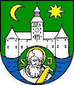
-
Hvozdnica est un village de Slovaquie situé dans la région de Žilina.
Histoire
Première mention écrite du village en 1250.
Notes et références
Catégories :
- Village de Slovaquie
- Village et ville du district de Bytča
Wikimedia Foundation.
2010.
Contenu soumis à la licence CC-BY-SA. Source : Article Hvozdnica de Wikipédia en français (auteurs)
Regardez d'autres dictionnaires:
Hvozdnica — is a village and municipality in Bytča District in the Žilina Region of northern Slovakia.HistoryIn historical records the village was first mentioned in 1317.GeographyThe municipality lies at an altitude of 159 metres and covers an area of… … Wikipedia
Visnove — Višňové ist der Name mehrerer Orte: einer Gemeinde im Okres Nové Mesto nad Váhom, Trenčiansky kraj, Slowakei siehe Višňové (Nové Mesto nad Váhom) einer Gemeinde im Okres Žilina, Žilinský kraj, Slowakei siehe Višňové (Žilina) einer Ortschaft in… … Deutsch Wikipedia
Višňové — ist der Name folgender Orte: einer Gemeinde im Okres Nové Mesto nad Váhom, Trenčiansky kraj, Slowakei siehe Višňové (Nové Mesto nad Váhom) einer Gemeinde im Okres Žilina, Žilinský kraj, Slowakei siehe Višňové (Žilina) einer Ortschaft in der… … Deutsch Wikipedia
Bytča — Coordinates: 49°13′27″N 18°33′51″E / 49.22417°N 18.56417°E / 49.22417; 18.56417 … Wikipedia
Žilina Region — Geobox | Region name = Žilina other name = category = Region image caption = symbol = CoA Žilina Region Slovakia.png symbol type = Coat of arms etymology = official name = motto = nickname = country = Slovakia country state = region = district =… … Wikipedia
Bytča District — Infobox Slovak district subject name = Bytča District region district slovak region = Žilina Region population = 30,879 (2005) prefix = 41 area = 282 car plate = BY image location = Okres bytca.png Bytča District ( okres Bytča ) is a district… … Wikipedia
List of municipalities and towns in Slovakia — Slovakia This is a comprehensive list of municipalities and towns in Slovakia. For lists of towns and municipalities sorted by Regions see the individual articles on Regions. For an outdated list of towns only in Slovakia see also List of towns… … Wikipedia
Maršová-Rašov — Location of Bytča District in the Žilina Region Maršová Rašov is a village and municipality in Bytča District in the Žilina Region of northern Slovakia. History In historical records the village was fir … Wikipedia
Bytca — Bytča Wappen Karte … Deutsch Wikipedia
Bytča — Wappen Karte … Deutsch Wikipedia
 Slovaquie
 Hvozdnica