Port Heiden (Alaska)
- Port Heiden (Alaska)
-
56° 56′ 56″ N 158° 39′ 21″ W / 56.948889, -158.655833
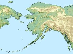
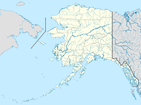
Port Heiden est une localité d'Alaska aux États-Unis dans le Borough de Lake and Peninsula. En 2010, il y avait 102 habitants.
Situation - climat
Elle est située à 424 milles (682 km) au sud-ouest d'Anchorage à l'embouchure de la rivière Meshik, près de l' Aniakchak National Monument and Preserve, sur le côté nord de la Péninsule de l'Alaska.
Les températures moyennes vont de 25 degrés Fahrenheit (-4 °C) en janvier, à 50 degrés Fahrenheit (10 °C) en juillet.
Histoire
L'ancien village de Meshik était situé sur le site actuel de Port Heiden. Mais l'épidémie de grippe de 1900 a obligé les habitants à déménager vers d'autres villages. Pendant la Seconde Guerre Mondiale, la base de Fort Morrow a été construite à proximité, et 5000 personnes y habitaient. Ce fort a été fermé à la fin de la guerre. Une école a ouvert en 1950, entraînant une recrudescence de la population. La communauté s'est déplacée à l'intérieur des terres à cause des dégâts de la mer qui avaient détruit un grand nombre de bâtiments.
Les habitants vivent de la pêche et de quelques emplois administratifs.
Articles connexes
Sources et références
Wikimedia Foundation.
2010.
Contenu soumis à la licence CC-BY-SA. Source : Article Port Heiden (Alaska) de Wikipédia en français (auteurs)
Regardez d'autres dictionnaires:
Port Heiden, Alaska — Infobox Settlement official name = Port Heiden, Alaska settlement type = City nickname = motto = imagesize = image caption = image mapsize = 250px map caption = Location of Port Heiden, Alaska mapsize1 = map caption1 = subdivision type = Country… … Wikipedia
Port Heiden Airport — IATA: PTH – ICAO: PAPH – FAA LID: PTH Summary … Wikipedia
Port Heiden — Port Heiden, AK U.S. city in Alaska Population (2000): 119 Housing Units (2000): 56 Land area (2000): 50.696412 sq. miles (131.303099 sq. km) Water area (2000): 0.659500 sq. miles (1.708097 sq. km) Total area (2000): 51.355912 sq. miles… … StarDict's U.S. Gazetteer Places
Port Heiden, AK — U.S. city in Alaska Population (2000): 119 Housing Units (2000): 56 Land area (2000): 50.696412 sq. miles (131.303099 sq. km) Water area (2000): 0.659500 sq. miles (1.708097 sq. km) Total area (2000): 51.355912 sq. miles (133.011196 sq. km) FIPS… … StarDict's U.S. Gazetteer Places
Alaska locations by per capita income — Alaska has the fourteenth highest per capita income in the United States of America, at $22,660 (2000). Its personal per capita income is $33,568 (2003), the twelfth highest in the country. Its median household income is $51,571 (2000), ranked… … Wikipedia
Alaska Central Express — Airline codes|KO|AER|Ace Air is an airline based in Anchorage, Alaska, USA. It is an Alaskan owned cargo and small package express service. Its main base is Ted Stevens Anchorage International Airport.cite news | title= Directory: World Airlines… … Wikipedia
Alaska World War II Army Airfields — Infobox Military Structure name=Alaska World War II Army Airfields partof = World War II location= coordinates= caption= type=Army Airfields code= built=1942 1944 builder= materials= height= used= 1942 Present demolished= condition= ownership=… … Wikipedia
List of Alaska Native tribal entities — rThis is a list of Alaska Native tribal entities which are recognized by the United States Bureau of Indian Affairs. For related lists, see the List of Indian reservations in the United States, List of Native American Tribal Entities (federally… … Wikipedia
National Register of Historic Places listings in Lake and Peninsula Borough, Alaska — Location of the Lake and Peninsula Borough in Alaska This is a list of the National Register of Historic Places listings in Lake and Peninsula Borough, Alaska. This is intended to be a complete list of the properties and districts on the National … Wikipedia
Nondalton, Alaska — Nondalton City Nondalton Village on Six Mile Lake … Wikipedia
 États-Unis
 Alaska


