Podtureň

Podtureň
Podtureň
(Village)
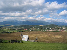
Längste Autobahnbrück in der Slowakei in der nähe von Liptovský Ján.jpg
Administration
Pays Drapeau de Slovaquie Slovaquie
Région Région de Žilina
District District de Liptovský Mikuláš
Code postal 033 01
Plaque minéralogique LM
Starosta (maire) Marián Vojtík ( SMER )

Mandat: 2013

Démographie
Population 745 hab. (31.12.2008)
Densité 146,6 hab./km2
Géographie
Coordonnées 49° 03′ 15″ Nord
       19° 41′ 30″ Est
/ 49.054167, 19.691667
Altitude 620 m
Superficie 508,1402 ha = 5,081402 km²
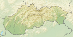
Localisation en Slovaquie
Voir la carte physique
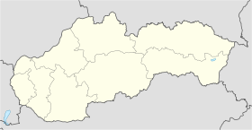
Localisation de la ville
Podtureň
Voir la carte administrative
Localisation de la ville
Podtureň
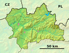
Localisation dans la région de Žilina
Voir la carte physique
Localisation de la ville
Podtureň
Voir la carte administrative
Localisation de la ville
Podtureň
Internet
Site de la commune http://www.podturen.sk
Sources
Resultat des élections
http://www.e-obce.sk [1]
http://www.statistics.sk [2]
http://www.slovakregion.sk/ [3]


Podtureň (hongrois : Pottornya)[4] est un village de Slovaquie situé dans la région de Žilina.

Histoire

La première mention écrite du village date de 1345[2].

Notes et références

  1. (sk) e-obce.sk. Consulté le 11 février 2010
  2. a et b (sk) (en) Mestská a obecná štatistika SR. Consulté le 11 février 2010
  3. (sk) Slovak region. Consulté le 11 février 2010
  4. (sk) Slovenské slovníky. Consulté le 11 février 2010


Wikimedia Foundation. 2010.

Contenu soumis à la licence CC-BY-SA. Source : Article Podtureň de Wikipédia en français (auteurs)

Игры ⚽ Нужно решить контрольную?

Regardez d'autres dictionnaires:

  • Podturen — Podturen …   Deutsch Wikipedia

  • Podturen — Pays  Croatie Comitat Međimurje Population (municipalité) 4 392 hab. (2001) …   Wikipédia en Français

  • Podturen — is a municipality in Međimurje County, Croatia. There are 4,392 inhabitants, absolute majority who are Croats (2001 census).Podturen municipality is the only municipality in Croatia that borders with Slovenia and Hungary together. *Podturen has… …   Wikipedia

  • Podtureň — is a village and municipality in Liptovský Mikuláš District in the Žilina Region of northern Slovakia.HistoryIn historical records the village was first mentioned in 1345.GeographyThe municipality lies at an altitude of 615 metres and covers an… …   Wikipedia

  • Pòdturen — m naselje (u blizini Čakovca) …   Veliki rječnik hrvatskoga jezika

  • Podturen — Pòdturen m DEFINICIJA naselje (u blizini Čakovca), 1735 stan …   Hrvatski jezični portal

  • Podturen — Original name in latin Podturen Name in other language Podturen State code HR Continent/City Europe/Zagreb longitude 46.46472 latitude 16.54306 altitude 156 Population 1550 Date 2012 01 19 …   Cities with a population over 1000 database

  • Podtureň Viaduct — ( sk. Most Podtureň/Viadukt Podtureň) is a 1 035 m long highway bridge in northern Slovakia, located on the D1 motorway, around 10 km east of Liptovský Mikuláš. It was built from 1975 to 1983. It spans the Váh river valley, several roads, main… …   Wikipedia

  • Mursko Sredisce — Mursko Središće …   Deutsch Wikipedia

  • Međimurje County — Međimurje redirects here. For the football club, see NK Međimurje. Međimurje County Međimurska županija   County   …   Wikipedia

Share the article and excerpts

Direct link
Do a right-click on the link above
and select “Copy Link”