Podbranč
- Podbranč
-
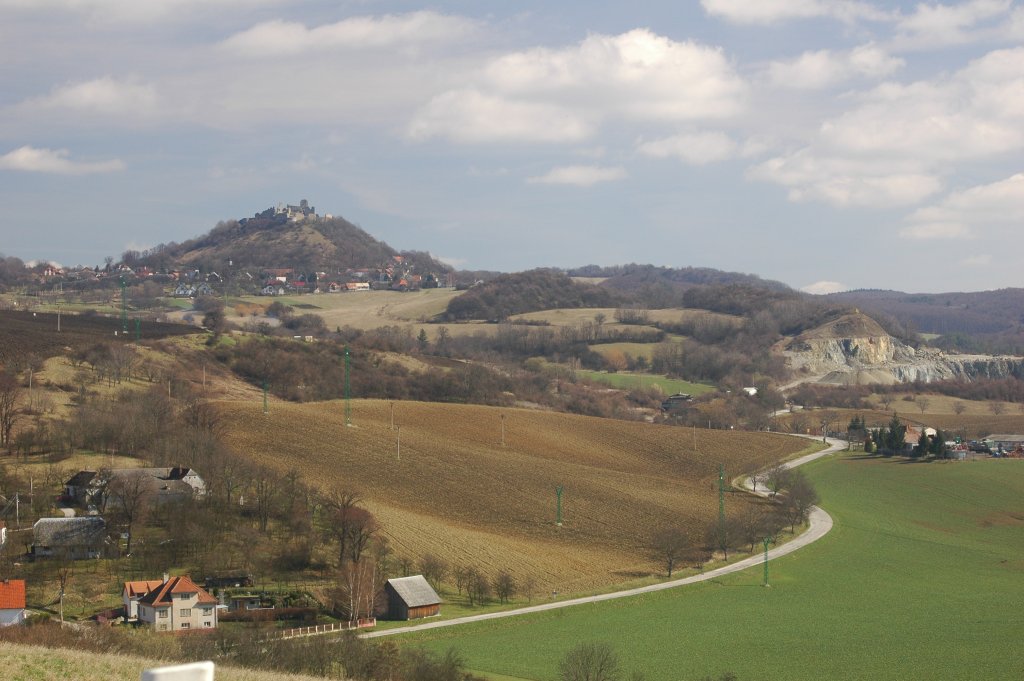
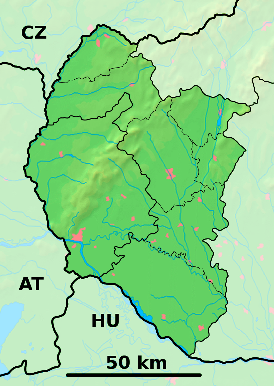
Podbranč (allemand : Unterbrantsch )[4] est un village de Slovaquie situé dans la région de Trnava.
Histoire
Première mention écrite du village en 1297.
Notes et références
Catégories :
- Village de Slovaquie
- Village et ville du district de Senica
Wikimedia Foundation.
2010.
Contenu soumis à la licence CC-BY-SA. Source : Article Podbranč de Wikipédia en français (auteurs)
Regardez d'autres dictionnaires:
Podbranč — Geobox | Settlement name = Podbranč other name = category = Village image caption = Branč Castle above the village symbol = etymology = official name = motto = nickname = country = Slovakia country state = region = Trnava district = Senica… … Wikipedia
Trnava Region — Geobox | Region name = Trnava category = Region image caption = image caption = symbol = symbol type = etymology = official name = motto = nickname = country = Slovakia country state = region = district = commune = municipality = border = part… … Wikipedia
Senica District — District Country Slovakia Region ( … Wikipedia
List of municipalities and towns in Slovakia — Slovakia This is a comprehensive list of municipalities and towns in Slovakia. For lists of towns and municipalities sorted by Regions see the individual articles on Regions. For an outdated list of towns only in Slovakia see also List of towns… … Wikipedia
Cerová — For other uses, see Cerova (disambiguation) Location of Senica District in the Trnava Region … Wikipedia
Dojč — Location of Senica District in the Trnava Region Church in Doj … Wikipedia
Moravský Svätý Ján — Coordinates: 48°35′00″N 17°01′00″E / 48.5833333°N 17.0166667°E / 48.5833333; 17.0166667 … Wikipedia
Osuské — Location of Senica District in the Trnava Region Osuské is a village and municipality in Senica District in the Trnava Region of western Slovakia. There is a catholic church first mentioned in 1468 with an organ rebuilted in 1844. Osuské was well … Wikipedia
Pieniny Klippen Belt — is tectonically, orographically significant zone of Western Carpathians, with very complicated geological structure. It is a narrow (only 0.4 to 19 km) and extremely long (about 600 km) north banded zone of extreme shortening, after subduction of … Wikipedia
Borsky Mikulas — Borský Mikuláš Wappen Karte … Deutsch Wikipedia

 Slovaquie
 Podbranč