Peconic Bay
- Peconic Bay
-
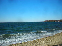
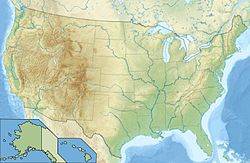
Peconic Bay est une baie des États-Unis située à l'est de l'île de Long Island entre deux péninsules baptisées respectivement North Fork et South Fork, tout en étant isolée de l'Océan Atlantique et de la Gardiners Bay par la Shelter Island.
En réalité, est séparée en deux parties par Robins Island :
- la Great Peconic Bay, l'ouest ;
- la Little Peconic Bay, à l'est.
La première est une baie peu profonde (9 m maximum) et se termine à son extrémité occidentale par la Flanders Bay dans laquelle se jette la Peconic River. Elle communique également avec la Great South Bay (« Grande baie sud ») par le Canal Shinnecock qui marque la limite ouest du South Fork. Tandis que seconde peu atteindre des profondeurs de 25 mètres.
Wikimedia Foundation.
2010.
Contenu soumis à la licence CC-BY-SA. Source : Article Peconic Bay de Wikipédia en français (auteurs)
Regardez d'autres dictionnaires:
Peconic Bay — The Peconic Bay is the parent name for two bays between the North Fork and South Fork of Long Island in the U.S. state of New York. It is divided by Robins Island into the Great Peconic Bay on the west and Little Peconic Bay. Little Peconic Bay… … Wikipedia
Peconic Bay — … Useful english dictionary
Great Peconic Bay — Sp Didžióji Pekòniko įlanka Ap Great Peconic Bay L V Atlante, JAV (Long Ailando s.) … Pasaulio vietovardžiai. Internetinė duomenų bazė
Peconic — may refer to:*Peconic, New York, a hamlet in Suffolk County, New York *Peconic Bay, two bodies of water between the North Fork and the South Fork of Long Island, New York **Great Peconic Bay, the body of water between the North Fork and the South … Wikipedia
Peconic County, New York — Peconic County is a proposed new county in New York that would secede the five easternmost towns of Suffolk County: East Hampton, Riverhead, Shelter Island, Southampton and Southold, plus the Shinnecock Indian Reservation. It derives its name… … Wikipedia
Peconic River — Infobox River river name = Peconic River caption = origin = Brookhaven National Laboratory mouth = Riverhead/Flanders Bay basin countries = United States length = convert|15|mi|km|0|abbr=on elevation = convert|249|ft|m|0 mouth elevation = 0… … Wikipedia
Peconic, New York — Infobox Settlement official name = Peconic, New York settlement type = CDP nickname = motto = imagesize = image caption = image mapsize = 250px map caption = pushpin mapsize1 = map caption1 = subdivision type = Country subdivision name = United… … Wikipedia
Gardiners Bay — is a small arm of the Atlantic Ocean, approximately 10 mi (16 km) long and 8 mi (13 km) wide in the U.S. state of New York between the two flukelike peninsulas at the eastern end of Long Island. It is bounded on its eastern end, where it connects … Wikipedia
Oyster Bay National Wildlife Refuge — The Oyster Bay National Wildlife Refuge on the north shore of Long Island consists of high quality marine habitats that support a variety of aquatic dependent wildlife. The refuge s waters and marshes surround Sagamore Hill National Historic Site … Wikipedia
Cumberland Bay State Park — is located in the Town of Plattsburgh in Clinton County, New York, on the Cumberland Head peninsula. The park is adjacent to Lake Champlain. The park offers a beach, picnic tables, a playground, and playing fields, recreation programs, a… … Wikipedia

 États-Unis


