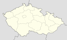
Ostrožská Lhota
Contenu soumis à la licence CC-BY-SA. Source : Article Ostrožská Lhota de Wikipédia en français (auteurs)
Regardez d'autres dictionnaires:
Ostrožská Lhota — Ostrožská Lhota … Deutsch Wikipedia
Ostrožská Lhota — Coordinates: 48°58′31″N 17°28′25″E / 48.97528°N 17.47361°E / 48.97528; 17.47361 … Wikipedia
Ostrozska Lhota — Original name in latin Ostrosk Lhota Name in other language State code CZ Continent/City Europe/Prague longitude 48.97559 latitude 17.46751 altitude 200 Population 1633 Date 2006 11 25 … Cities with a population over 1000 database
Ostrožská Nová Ves — Ostrožská Nová Ves … Deutsch Wikipedia
Ostrožská Nová Ves — Municipality … Wikipedia
Ostrožská Nová Ves — Administration Pays Tcheque, republique ! … Wikipédia en Français
Lhota — is a popular name of Czech villages, founded during the Middle age colonization in Bohemia, Moravia and Slovakia. It is assumed that most of them were founded in the 13th century and the first half of the 14th century. The name was first… … Wikipedia
Chylice (Ostrožská Nová Ves) — Chylice … Deutsch Wikipedia
Uherský Ostroh — Uherský Ostroh … Deutsch Wikipedia
Ungarisch Ostra — Uherský Ostroh Hilfe zu Wappen … Deutsch Wikipedia
 République tchèque
