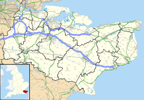
Newbarn
Contenu soumis à la licence CC-BY-SA. Source : Article Newbarn de Wikipédia en français (auteurs)
Regardez d'autres dictionnaires:
Newbarn — Not to be confused with New Barn or Newbarns. Coordinates: 51°07′03″N 1°04′58″E / 51.1176°N 1.0827°E / 51.117 … Wikipedia
Norton Malreward — Coordinates: 51°23′16″N 2°34′23″W / 51.3877°N 2.573°W / 51.3877; 2.573 … Wikipedia
Etchinghill, Kent — infobox UK place country = England static static image caption=A converted chapel in Etchinghill latitude= 51.113 longitude=1.0946 official name=Etchinghill population = shire district= Shepway shire county = Kent region= South East England… … Wikipedia
Brighstone Forest — is located in the southwest of the Isle of Wight. It is the largest forest on the Isle of Wight, being just a few hectares larger than Parkhurst Forest. It is spread over a number of hilly ridges which form the backbone of the Isle of Wight. From … Wikipedia
New Barn — Not to be confused with Newbarn or Newbarns. Coordinates: 51°23′44″N 0°19′37″E / 51.395480°N 0.326980°E / … Wikipedia
List of townlands of County Dublin — Ireland portal List of townlands in County Dublin This is a sortable table of the approximately 1,090 townlands in County Dublin, Ireland. [1] … Wikipedia
Newbarns — Roundabout at Harrel, Flass and Rating Lane … Wikipedia
Beachborough — House Administration Pays … Wikipédia en Français

