Mahaela

Mahaela

20° 58′ 00″ S 48° 27′ 00″ E / -20.966667, 48.45

Mahaela
Administration
Pays Drapeau de Madagascar Madagascar
Région Vatovavy-Fitovinany
Province Fianarantsoa
District Mananjary
Géographie
Coordonnées 20° 58′ 00″ Sud
       48° 27′ 00″ Est
/ -20.966667, 48.45
Altitude 6 m
Démographie
Population 23000[1] hab. (est. 2001)
Localisation
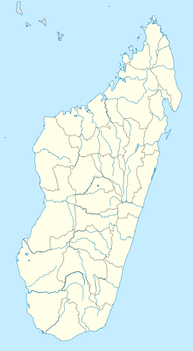
Madagascar location map.svg
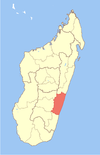
City locator 14.svg

Mahaela est une commune urbaine malgache située dans la partie centre-est de la région de Vatovavy-Fitovinany.

Sommaire

Géographie

Démographie

Économie

Notes et références

Voir aussi

Articles connexes


Wikimedia Foundation. 2010.

Contenu soumis à la licence CC-BY-SA. Source : Article Mahaela de Wikipédia en français (auteurs)

Игры ⚽ Нужно решить контрольную?

Regardez d'autres dictionnaires:

  • Mahaela — Mahaela …   Wikipedia

  • Manakara — is a city in Madagascar. It is the capital of Vatovavy Fitovinany Region. The city is located at the east coast and has a small port. It is the endpoint of the Fianarantsoa Côte Est railway (FCE), which connects the city of Fianarantsoa with the… …   Wikipedia

  • Mananjary, Fianarantsoa — Mananjary [mananˈdzarʲ] is a fivondronana (urban region) located in Vatovavy Fitovinany Region in Madagascar. The region has a total population of 233,697 (2001 census). It contains a town of the same name, situated on the southern part of the… …   Wikipedia

  • Mizilo Gara — Mizilo Gara …   Wikipedia

  • Mahabako — Mahabako …   Wikipedia

  • Mahamaibe — Mahamaibe …   Wikipedia

  • Mangatsiotra — Mangatsiotra …   Wikipedia

  • Marofarihy — Marofarihy …   Wikipedia

  • Mavorano — Mavorano …   Wikipedia

  • Mitanty — Country  Madagascar Region Vatovavy Fitovinany District Manakara …   Wikipedia

Share the article and excerpts

Direct link
Do a right-click on the link above
and select “Copy Link”