Lochboisdale
Contenu soumis à la licence CC-BY-SA. Source : Article Lochboisdale de Wikipédia en français (auteurs)
Regardez d'autres dictionnaires:
Lochboisdale — Koordinaten 57° 9′ N, 7° 19′ W … Deutsch Wikipedia
Lochboisdale — Infobox UK place official name= Lochboisdale gaelic name= Loch Baghasdail latitude= 57.15 longitude= 7.31 country= Scotland os grid reference= post town= ISLE OF SOUTH UIST postcode area= HS postcode district= HS8 dial code= 01878 constituency… … Wikipedia
Loch Baghasdail — Lochboisdale (Gälisch: Loch Baghasdail) ist mit etwa 1100 Einwohnern[1] das wichtigste Bevölkerungszentrum der Insel South Uist, Äußere Hebriden, Schottland. Die Stadt profitierte vom Heringboom im 19. Jahrhundert, und 1880 wurde ein Anleger für… … Deutsch Wikipedia
Telephone numbers in the United Kingdom — +44 redirects here. For the band, see +44 (band). United Kingdom telephone numbers Location of United Kingdom (dark green) Location Country United Kingdom Continent … Wikipedia
Loch Baghasdail — Ne doit pas être confondu avec Lochboisdale. Loch Baghasdail Géographie humaine Pays côtier(s) … Wikipédia en Français
South Uist — Infobox Scottish island GridReference=NF786343 celtic name= Uibhist a Deas norse name= meaning of name= From inni vist , Old Norse for dwelling . area=32,026 ha area rank=9 highest elevation= Beinn Mhor 620 m Population=1,818 population rank=9… … Wikipedia
Daliburgh — Coordinates: 57°10′N 7°22′W / 57.17°N 7.37°W / 57.17; 7.37 … Wikipedia
Castlebay — Infobox UK place official name= Castlebay gaelic name= Bàgh a Chaisteil latitude= 56.95 longitude= 7.49 country= Scotland os grid reference= post town= ISLE OF BARRA postcode area= HS postcode district= HS9 dial code= 01871 constituency… … Wikipedia
Ardmore, Barra — Infobox UK place official name= Ardmore gaelic name= Aird Mhòr latitude= 57.01 longitude= 7.40 country= Scotland os grid reference= post town= ISLE OF BARRA postcode area= HS postcode district= HS9 dial code= 01871 constituency westminster= Na h… … Wikipedia
Beinn Ruigh Choinnich — Infobox Mountain Name = Beinn Ruigh Choinnich Photo = Caption = Elevation = 275 m (902 ft) Location = South Uist, Western Isles, Scotland Prominence = 169 m Coordinates = Topographic Type = First ascent = Easiest route = Grid ref UK = NF809196… … Wikipedia
 Royaume-Uni
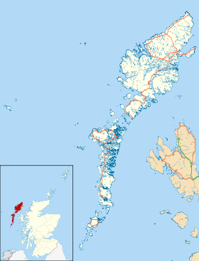
 Lochboisdale
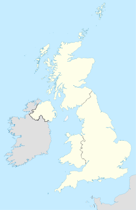
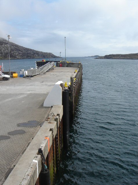
 Vue de la jetée de Loichboisdale.
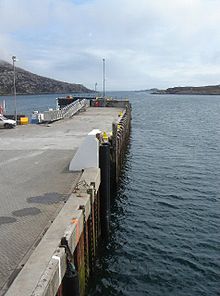