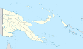
Kundiawa
Contenu soumis à la licence CC-BY-SA. Source : Article Kundiawa de Wikipédia en français (auteurs)
Regardez d'autres dictionnaires:
Kundiawa — Infobox PNG Place type = town name = Kundiawa othername = province = sim llg = Kundiawa Urban lang = English, Tok Pisin, Kuman, Dom, Sinasina langarea = Kuman dot x = 63 dot y = 74 caption = Kundiawa aerial photograph. pop = 8,147 popdate = 2000… … Wikipedia
Kundiawa — Original name in latin Kundiawa Name in other language CMU, Kundiawa State code PG Continent/City Pacific/Port Moresby longitude 6.01667 latitude 144.96667 altitude 1539 Population 9383 Date 2012 01 16 … Cities with a population over 1000 database
Kundiawa — ▪ Papua New Guinea town, central Papua New Guinea, southwestern Pacific Ocean. The town, built on an old Lutheran mission site, is located on a pine covered hilltop surrounded by mountains, waterfalls, coffee plantations, and vegetable… … Universalium
Bistum Kundiawa — Basisdaten Staat Papua Neuguinea Metropolitanbistum Erzbistum Mount Hagen … Deutsch Wikipedia
Roman Catholic Diocese of Kundiawa — The Roman Catholic Diocese of Kundiawa is a suffragan diocese of the Roman Catholic Archdiocese of Mount Hagen in Papua New Guinea. It was erected in 1982, having been separated from the Diocese of Goroka. Bishops*William Joseph Kurtz, S.V.D.… … Wikipedia
Simbu Province — Coordinates: 6°26′S 145°0′E / 6.433°S 145°E / 6.433; 145 … Wikipedia
Chimbu Province — Chimbu Geographie Staat: Papua Neuguinea Gewässer: Pazifischer Ozean Inseln … Deutsch Wikipedia
Chimbu Airport — IATA: CMU – ICAO: AYCH … Wikipedia
Highlands Highway — Route information Length: 700 km (400 mi) Existed: 1950s – present Major junctions East end: Lae … Wikipedia
Districts and LLGs of Papua New Guinea — Districts and LLGs of Papua New Guinea … Wikipedia
 Papouasie-Nouvelle-Guinée
