Komatipoort
- Komatipoort
-
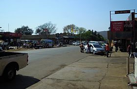
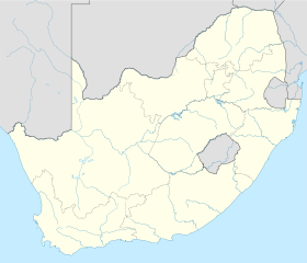
Komatipoort est une ville située au confluent des rivières Crocodile et Komati dans la province du Mpumalanga en Afrique du Sud. La ville est située à 8 km du Parc Kruger et à 5 km de la frontière avec le Mozambique (Lebombo Border Post). C'est l'une des villes les plus chaudes d'Afrique du Sud, les températures peuvent atteindre 50°C en plein été et 24°C en hiver.
Le traité de non agression dit Accord de Nkomati entre le Mozambique et l'Afrique du Sud a été signé à Komatipoort en 1984[1].
Notes et références
Liens externes
Catégories : - Ville d'Afrique du Sud
- Ville du Mpumalanga
Wikimedia Foundation.
2010.
Contenu soumis à la licence CC-BY-SA. Source : Article Komatipoort de Wikipédia en français (auteurs)
Regardez d'autres dictionnaires:
Komatipoort — Komatipoort … Deutsch Wikipedia
Komatipoort — is a town situated at the confluence of the Crocodile and Komati Rivers in Mpumalanga province, South Africa. It is one of South Africa s hottest towns, with winter s average a perfect 26°C (79°F) moving to a summer average of 33°C (91°F).… … Wikipedia
Komatipoort — es una localidad situada en la confluencia de los ríos Crocodile y Komati en la provincia de Mpumalanga, Sudáfrica. Es una de las localidades más calurosas de Sudáfrica, con una media de 26°C (79°F) en invierno y 33°C (91°F) en verano. Está… … Wikipedia Español
Komatipoort — Original name in latin Komatipoort Name in other language KOF, Komatipoort State code ZA Continent/City Africa/Johannesburg longitude 25.4332 latitude 31.95478 altitude 159 Population 20508 Date 2012 07 12 … Cities with a population over 1000 database
1986 Mozambican Tupolev Tu-134 crash — Mozambican Presidential Jet A Tupolev Tu 134, similar to the aircraft that was involved in the accident Accident summary Date … Wikipedia
Mozambican Tupolev Tu-134 air disaster — Infobox Airliner accident name = Mozambican Presidential Jet Date = October 19, 1986 Type = Controlled flight into terrain Coordinates = coord|25|54|58|S|31|57|19|E|display=inline,title Site = Mbuzini, Lebombo Mountains, South Africa Fatalities … Wikipedia
Komati — River, Rio Incomáti Die Schlucht nahe Carolina (Provinz Mpumalanga) am oberen KomatiVorlage:Infobox Fluss/KARTE fe … Deutsch Wikipedia
Britisch-Südafrika — Britisch Südafrika. (Vgl. Karte, Tafel IV). Der Südafrikanische Staatenbund. Das Eisenbahnnetz in B. hat sich ungemein rasch entwickelt. Die erste Eisenbahn entstand in Natal im Jahre 1860 von Durban nach Point, die nächste von Kapstadt nach… … Enzyklopädie des Eisenbahnwesens
Kruger National Park — IUCN Category II (National Park) Landscape in the Kruger National Park … Wikipedia
Nkomati Accord — Graca Machel, Samora Machel, PW Botha and Pik Botha at the signing of the Nkomati Accord, Komatipoort, 1984. The Nkomati Accord was a non aggression pact signed on 16 March 1984 between the government of the People s Republic of Mozambique and… … Wikipedia
 Afrique du Sud

