Beidi

Beidi

Baiti

0°30′25″S 166°55′54″E / -0.50694, 166.93167

Baiti
(Baitsi/Beidi)
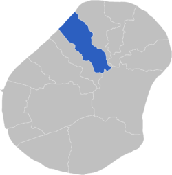
Carte de localisation du district de Baiti.
Administration
Pays Nauru Nauru
Type District
Date de création 1968
Géographie
Superficie 1,23 km²
Altitude maximale 45 m
Altitude minimale 0 m
Démographie
Population 443 hab. (2002[1])
Densité 360,2 hab./km²

Baiti, en nauruan Baitsi ou Beidi, est un des quatorze districts de Nauru. Le district de Baiti fait partie de la circonscription électorale d'Ubenide.

Sommaire

Géographie

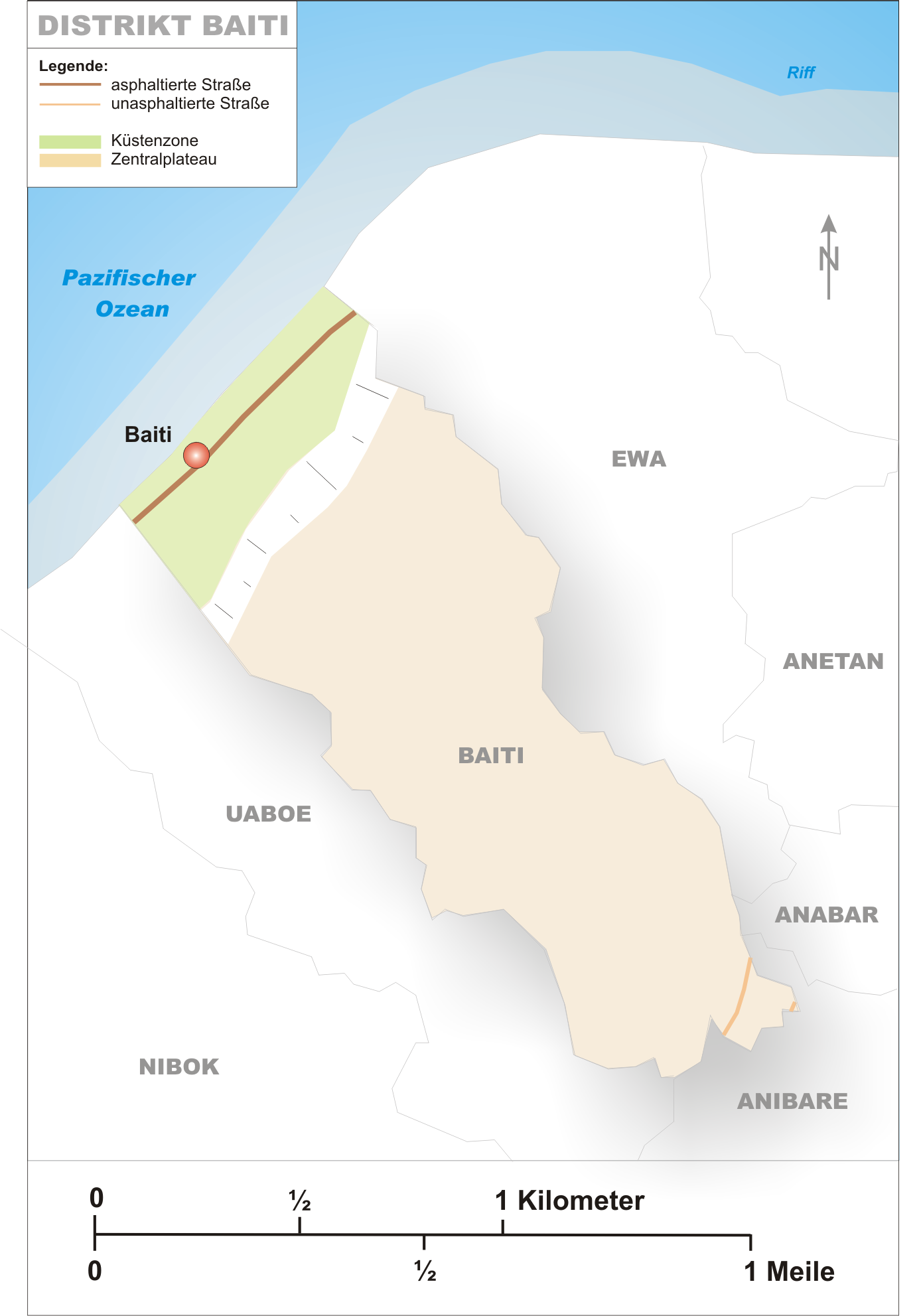
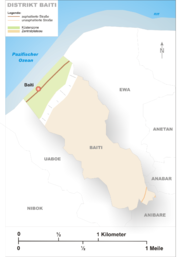
Carte du district de Baiti.

Baiti se trouve dans le Nord-Ouest de l'île de Nauru. Il est bordé par l'océan Pacifique au nord-ouest et par les districts de Ewa au nord-est, Anabar à l'Est, Anibare au sud-est et Uaboe au sud-ouest.

Son altitude moyenne est de 25 mètres (minimale : 0 mètre, maximale : 45 mètres) et sa superficie est de 1,2 km2 (septième rang sur quatorze).

Population

Baiti est peuplé de 443 habitants (huitième rang sur quatorze) avec une densité de population de 360,2 hab/km2[1]. La zone correspondant au district de Baiti était composée à l'origine de 15 villages : Adrurior, Aeonun, Anakawida, Anut, Ataneu, Atirabu, Baiti, Deradae, Ibedwe, Imangengen, Imaraga, Mangadab, Mereren, Umaruru et Yatabang.

Annexes

Lien externe

Commons-logo.svg

Références

  • (de) Cet article est partiellement ou en totalité issu d’une traduction de l’article de Wikipédia en allemand intitulé « Baiti (Distrikt) ».
  • (en) Cet article est partiellement ou en totalité issu d’une traduction de l’article de Wikipédia en anglais intitulé « List of cities in Nauru ».
  1. a  et b (en)Nauru bureau of statistics, « Average household size by district, Nauru, 2002 », 2007. Consulté le 16 novembre 2008
  • Portail de Nauru Portail de Nauru
Ce document provient de « Baiti ».

Wikimedia Foundation. 2010.

Contenu soumis à la licence CC-BY-SA. Source : Article Beidi de Wikipédia en français (auteurs)

Игры ⚽ Нужна курсовая?

Regardez d'autres dictionnaires:

  • Beidi — (北狄) is a term that originally denoted an ancient ethnic group (Di) but was used to refer to all non Han Chinese ethnic groups in today s Northern China, Mongolia, and Siberia, especially those who lived beyond the Great Wall of China, such as… …   Wikipedia

  • Super 8 Hotel Shanghai Hongqiao Airport Beidi Road — (Hongqiao,Китай) Категория отеля: 3 звездочный отель Адрес …   Каталог отелей

  • Dongyi — Gui (鬹) from Dawenkou culture Dongyi (traditional Chinese: 東夷; simplified Chinese: 东夷; pinyin …   Wikipedia

  • Peuls —  Pour la langue, voir Peul.  Peuls Fulɓe Peuls wodaabe du Niger …   Wikipédia en Français

  • Di (ethnic group) — The Di (Chinese: 氐; pinyin: Dǐ; Wade–Giles: Ti3) were an ethnic group in China from the 8th century BCE to approximately the middle of the 6th century CE. Note that the character Di (氐) is used to differentiate this group from the Beidi (北狄), a… …   Wikipedia

  • Qibo — (zh cpw|c=岐伯|p=Qíbó|w=Chi Bo), was a mythological Chinese doctor, employed by Huangdi (the Yellow Emperor) as his minister. It is said that he was enlightened with the knowledge of traditional Chinese medicine by an ethereal being from the… …   Wikipedia

  • Ubenide — Lage Ubenides Karte von Ubenide Andere Distrikte/Wahlkreise Fläche …   Deutsch Wikipedia

  • Baiti — 0°30′25″S 166°55′54″E / 0.50694, 166.93167 …   Wikipédia en Français

  • Baitsi — Baiti 0°30′25″S 166°55′54″E / 0.50694, 166.93167 …   Wikipédia en Français

  • Donghu people — The Donghu were located to the northeast of Qin China in the 3rd century BCE. Donghu (simplified Chinese: 东胡; traditional Chinese: 東胡; pinyin: Dōnghú; Wade–Giles: Tung hu; literally: Eastern Foreigners or Eastern barbarians ) was the name of a… …   Wikipedia

Share the article and excerpts

Direct link
Do a right-click on the link above
and select “Copy Link”