Hjalteyri
- Hjalteyri
-
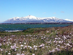
Hjalteyri est une commune islandaise de la municipalité de Arnarneshreppur située à l'est de l'île, dans la région de Norðurland eystra. En 2011, le village comptait 43 habitants.
Géographie
Cette section est vide, insuffisamment détaillée ou incomplète.
Votre aide est la bienvenue !
Toponymie
Cette section est vide, insuffisamment détaillée ou incomplète.
Votre aide est la bienvenue !
Histoire
Cette section est vide, insuffisamment détaillée ou incomplète.
Votre aide est la bienvenue !
Administration
Jumelages
Cette section est vide, insuffisamment détaillée ou incomplète.
Votre aide est la bienvenue !
Démographie
Cette section est vide, insuffisamment détaillée ou incomplète.
Votre aide est la bienvenue !
Économie
Cette section est vide, insuffisamment détaillée ou incomplète.
Votre aide est la bienvenue !
Patrimoine naturel et architectural
Cette section est vide, insuffisamment détaillée ou incomplète.
Votre aide est la bienvenue !
Personnalités liées à la commune
Cette section est vide, insuffisamment détaillée ou incomplète.
Votre aide est la bienvenue !
Annexes
Cette section est vide, insuffisamment détaillée ou incomplète.
Votre aide est la bienvenue !
Articles connexes
Liens externes
Références
Wikimedia Foundation.
2010.
Contenu soumis à la licence CC-BY-SA. Source : Article Hjalteyri de Wikipédia en français (auteurs)
Regardez d'autres dictionnaires:
Hjalteyri — Landgemeinde Arnarnes (Arnarneshreppur) Basisdaten Staat: Island Region: Norðurland eystra Wahlkreis: Norðausturkjördæmi … Deutsch Wikipedia
Hörgársveit — Basisdaten Staat: Island Region: Norðurland eystra Wahlkreis: Norðausturkjördæmi Sýsla … Deutsch Wikipedia
Eyjafjörður — is the longest fjord in central northern Iceland. It is located in the second most populous region of Iceland. The name literally means: Island Fjord which is derived from Hrísey island. Physical geography The fjord is long and narrow, it… … Wikipedia
Tröllaskagi — The peninsula is cut by several deep valleys that were formed by glaciers during ice ages and later by the rivers that now flow down those valleys. A few permanent glacier ice caps still exist in central Tröllaskagi but they are all rather… … Wikipedia
Dieter Roth — For the German political scientist, see Dieter Roth (political scientist). Dieter Roth Rhode Island, USA, 1965 Birth name Karl Dietrich Roth Born … Wikipedia
Arnarnes — Landgemeinde Arnarnes (Arnarneshreppur) Basisdaten Staat: Island Region: Norðurland eystra Wahlkreis: Norðausturkjördæmi … Deutsch Wikipedia
Arnarneshreppur — Landgemeinde Arnarnes (Arnarneshreppur) Basisdaten Staat: Island Region: Norðurland eystra Wahlkreis: Norðausturkjördæmi … Deutsch Wikipedia
IS-6 — Die acht Regionen Islands. Norðurland eystra ist Nr. 6 (grün) Norðurland eystra (östliches Nordland) ist eine der acht Regionen Islands. Sie liegt im Norden des Landes. Ihr Verwaltungssitz ist Akureyri. Am 1. Dezember 2008 lebten 29.060 Einwohner … Deutsch Wikipedia
Kristnes — Landgemeinde Arnarnes (Arnarneshreppur) Basisdaten Staat: Island Region: Norðurland eystra Wahlkreis: Norðausturkjördæmi … Deutsch Wikipedia
Liste der Städte in Island — Karte von Island Die Liste der Städte in Island bietet einen Überblick über die Entwicklung der Einwohnerzahl der größeren städtischen Siedlungen in Island. Aufgeführt ist auch eine alphabetische Liste aller bewohnten städtischen Siedlungen des… … Deutsch Wikipedia
 Islande
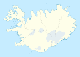
 Hjalteyri
