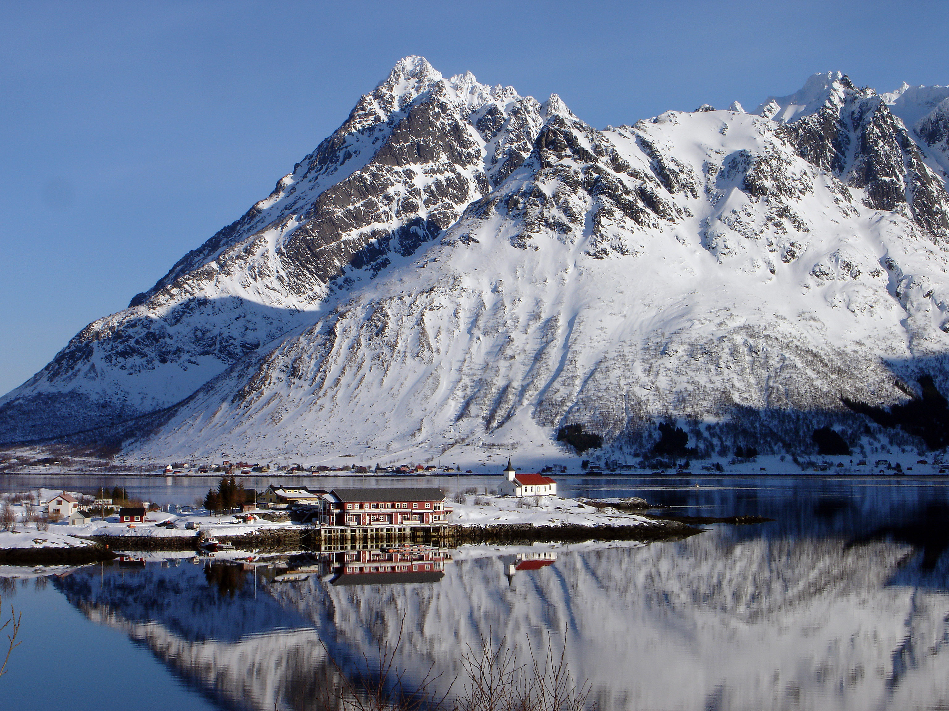
Higravstinden
Contenu soumis à la licence CC-BY-SA. Source : Article Higravstinden de Wikipédia en français (auteurs)
Regardez d'autres dictionnaires:
Higravstinden — Infobox Mountain Name = Higravstinden Photo = Caption = Elevation = convert|1146|m|ft|0|lk=on Location = Hadsel and Vågan, Nordland, NOR Range = Prominence = convert|1146|m|ft|0|abbr=on Coordinates = coord|68|21|25.0|N|14|47|20.7|E|type:mountain… … Wikipedia
Austvågøy — Infobox Islands name = Austvågøy image caption = Location of Austvågøy in the Lofoten archipelago, North Norway image size = locator native name = native name link = nickname = location = North Norway, Europe coordinates =… … Wikipedia
Austvågøy — Berg Vågkallen auf Austvågøy mit Ørsnes Gewässer Europäisches Nordmeer … Deutsch Wikipedia
Islas Lofoten — (Lofoten) Reine, Lofoten, visto desde lo alto del monte Reinebringen (junio de 2003) Localización geográfica / administrativa … Wikipedia Español
Lofoten — is an archipelago and a traditional district in the county of Nordland, Norway. Though lying within the Arctic Circle, the archipelago experiences one of the world s largest elevated temperature anomalies relative to its high latitude. Etymology… … Wikipedia
Iles Lofoten — Îles Lofoten Îles Lofoten Lofoten (nn) Carte des îles Lofoten et Vesteraalen. Géographie … Wikipédia en Français
Lofoten — Îles Lofoten Îles Lofoten Lofoten (nn) Carte des îles Lofoten et Vesteraalen. Géographie … Wikipédia en Français
Îles Lofoten — Lofoten (nn) Panorama du village de Reine, typique des Lofoten&# … Wikipédia en Français
Lofoten — Saltar a navegación, búsqueda Situación de Lofoten en Noruega Las islas Lofoten son un archipiélago y un distrito de Noruega, situado en el condado de Nordland, por encima del Círculo polar ártico … Wikipedia Español
Ауствогёя — норв. Austvågøy … Википедия

 Norvège