Gänserndorf
- Gänserndorf
-
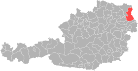
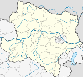
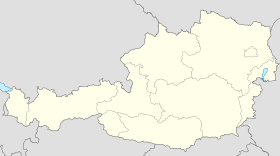
Gänserndorf est une commune autrichienne du district de Gänserndorf en Basse-Autriche.
Géographie
Gänserndorf se trouve environ 20 km de Vienne dans le Marchfeld. La ville est connecté à Vienne avec la route B8, la "Angerer Straße", et avec un train, la "Nordbahn".
Histoire
Cette section est vide,
insuffisamment détaillée ou incomplète.
Votre aide est la bienvenue !
Wikimedia Foundation.
2010.
Contenu soumis à la licence CC-BY-SA. Source : Article Gänserndorf de Wikipédia en français (auteurs)
Regardez d'autres dictionnaires:
Gänserndorf — Gänserndorf … Deutsch Wikipedia
Gänserndorf — Gänserndorf … Wikipedia Español
Gänserndorf — (Unter G.), Dorf in Niederösterreich, im Marchfeld, an den Linien Wien Lundenburg und G. Marchegg der Nordbahn gelegen, Sitz einer Bezirkshauptmannschaft, mit Dachpappenfabrik, Dampfmühle, Getreide und Holzhandel und (1900) 2113 Einw … Meyers Großes Konversations-Lexikon
Gänserndorf — Infobox Ort in Österreich Art = Stadt Name = Gänserndorf Wappen = lat deg = 48 | lat min = 20 | lat sec = 26 lon deg = 16 | lon min = 43 | lon sec = 03 Bundesland = Niederösterreich Bezirk = Gänserndorf Höhe = 167 Fläche = 30.56 Einwohner = 9056… … Wikipedia
Gänserndorf — Sp Geñzerndorfas Ap Gänserndorf L mst. ir adm. sr., Austrija … Pasaulio vietovardžiai. Internetinė duomenų bazė
Gänserndorf (district) — Infobox Austrian district subject name = Bezirk Gänserndorf region district region = Lower Austria population = 88,475 (2001) prefix = ? area = 1271.3 car plate = GF nuts code = AT125 municipalities = 44 image location = Karte Aut Noe GF.png… … Wikipedia
Gänserndorf — Gạ̈nserndorf, 1) Bezirkshauptstadt in Niederösterreich, 160 m über dem Meeresspiegel, 6 900 Einwohner; Hauptort des Marchfeldes, Mittelpunkt der österreichischen Erdölförderung; daneben Metallverarbeitung und Elektroindustrie. In der Nähe… … Universal-Lexikon
Ganserndorf — Original name in latin Gnserndorf Name in other language Genzerndorf, Unterganserndorf, Untergnserndorf, Гензерндорф State code AT Continent/City Europe/Vienna longitude 48.33925 latitude 16.72016 altitude 164 Population 8588 Date 2011 07 31 … Cities with a population over 1000 database
Lokalbahn Gänserndorf-Mistelbach — Gänserndorf–Mistelbach Lokalbahn Kursbuchstrecke (ÖBB): 912 Streckennummer: 183 01 Streckenlänge: in Betrieb: 22,98 km Spurweite: 1435 mm (Normalspur) Legende … Deutsch Wikipedia
Lokalbahn Gänserndorf–Mistelbach — Gänserndorf–Mistelbach Lokalbahn Kursbuchstrecke (ÖBB): 912 Streckennummer: 183 01 Streckenlänge: in Betrieb: 22,98 km Spurweite: 1435 mm (Normalspur) Legende … Deutsch Wikipedia

 Autriche
 Basse-Autriche
 Pas de légende à la carte


