Gogarloch
- Gogarloch
-
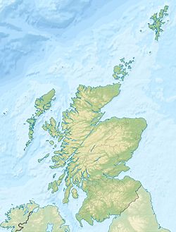
Gogarloch est un quartier résidentiel dans le quartier de South Gyle à Edimbourg, en Écosse. Il se trouve près de la gare de chemin de fer de South Gyle et de South Gyle Broadway, à 7 km à l'ouest du centre-ville. Corstorphine et Wester Broom sont à proximité.
Historiquement, cette région était marécageuse (d'où «loch» dans le nom) mais le terrain a été drainé au XIXe siècle pour créer de la place pour un nouveau chemin de fer. La plupart des logements date des années 1990.
D'autres anciens lochs d'Edimbourg, notamment le Nor Loch et Burgh Loch était sur le site de l'actuelle zone Meadows.
Liens internes
Wikimedia Foundation.
2010.
Contenu soumis à la licence CC-BY-SA. Source : Article Gogarloch de Wikipédia en français (auteurs)
Regardez d'autres dictionnaires:
Gogarloch — is a residential area within South Gyle, Edinburgh, Scotland. It lies near South Gyle railway station and South Gyle Broadway, 4½ miles (7 km) west of the city centre. Corstorphine and Wester Broom are nearby.Historically this area was marshland… … Wikipedia
South Gyle — is an area of Edinburgh, Scotland, lying on the western edge of the city and to the south and west of an area of former marshland once known as the Gogarloch, on the edge of Corstorphine. To the north, some streets in the area have names… … Wikipedia
Gogar — is a rural exurb of Edinburgh, Scotland, located to the west of the city. It is not far from Gogarloch, Edinburgh Park and Maybury. The Fife Circle Line is to the north of the city.HistoryThe name of Gogar first appears on a map in 1233. It may… … Wikipedia
Edinburgh — For other uses, see Edinburgh (disambiguation). City of Edinburgh Scottish Gaelic: Dùn Èideann Scots: Edinburgh Unitary Authority City City of Edinburgh … Wikipedia
Dean Village — The Dean Village Dean Village (from dene, meaning deep valley ) is a former village immediately northwest of Edinburgh, Scotland city centre. It was known as the Water of Leith Village and was a successful grain milling hamlet for more than 800… … Wikipedia
Leith — This article is about Leith, Scotland. For other uses, see Leith (disambiguation). Coordinates: 55°58′48″N 3°10′12″W / 55.980089°N 3.170049°W / … Wikipedia
Newhaven, Edinburgh — Newhaven harbour in overcast sunlight Newhaven is a district in the City of Edinburgh, Scotland, between Leith and Granton. Formerly a village and harbour on the Firth of Forth, it currently has approximately 5,000 inhabitants. Newhaven is a… … Wikipedia
Holyrood Park — (also called the Queen s Park or King s Park depending on the current monarch s gender) is a royal park in central Edinburgh, Scotland about a mile to the east of Edinburgh Castle. It has an array of hills, lochs, glens, ridges, basalt cliffs,… … Wikipedia
List of lochs in Scotland — The following is a list of lochs in Scotland. Loch is a Scottish Gaelic word for a lake or fiord, cognate with the Irish Gaelic lough , which has been borrowed by Scots and Scottish English to apply to such bodies of water, especially those… … Wikipedia
Cramond — Harbour Population 7,502 (2001) OS grid reference … Wikipedia
 Royaume-Uni
 Écosse)


