Godthul
- Godthul
-
Godthul (ou Godt Hul Harbour, Godthul Bay) est une baie située sur la côte nord-ouest de la Géorgie du Sud. Longue de 1,6 km, elle a été utilisée comme port et dépôt par les chasseurs de baleines norvégiens. Son nom signifie « bonne anse (ou crique) » en norvégien[1].
Notes et références
- ↑ Godthul, www.geonames.usgs.gov. Consulté le 3 août 2010
Wikimedia Foundation.
2010.
Contenu soumis à la licence CC-BY-SA. Source : Article Godthul de Wikipédia en français (auteurs)
Regardez d'autres dictionnaires:
Godthul — (coord|54|17|S|36|18|W|) is a bay 1 mile (1.6 km) long entered between Cape George and Long Point, on the north coast of South Georgia, between Cumberland East Bay and Ocean Harbour. The name Godthul (Norwegian for Good Hollow ) dates back to the … Wikipedia
South Georgia and the South Sandwich Islands — South Georgia and the South Sandwich Islands … Wikipedia
Montagu Island — … Wikipedia
Thule Island — Not to be confused with the town of Thule, Greenland. Thule Island Flag of South Georgia and the South Sandwich Islands. Locat … Wikipedia
Cumberland Bay — Central South Georgia: Cumberland Bay; Thatcher Peninsula with King Edward Cove (Grytviken); Allardyce Range with the summit Mt. Paget (NASA imagery). Cumberland Bay, 6 km (3.7 mi) wide at its entrance between Larsen and Barff Points,… … Wikipedia
Mount Paget — Location of Mt. Paget Elevation 2,935 m (9,629 ft) … Wikipedia
Cook Island, South Sandwich Islands — South Sandwich Islands Location of Cook Island Geography … Wikipedia
Corbeta Uruguay — This article concerns the Argentine base named after the ship Corvette Uruguay (Corbeta Uruguay), for the article concerning the ship, see ARA Uruguay. The Corbeta Uruguay station on Southern Thule in 1981 Corbeta Uruguay was an Argentine… … Wikipedia
Mount Belinda — False color image of the ongoing eruption of Mount Belinda (September 23, 2005). The graph indicates the amount of radiant heat (in megawatts). Elevation … Wikipedia
Clerke Rocks — The Clerke Rocks, can be seen on this North down Cook s map Geography Coordinates … Wikipedia
 Royaume-Uni
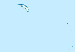


 Portail du monde maritime
 Portail des cétacés
 Portail de la Géorgie du Sud-et-les Îles Sandwich du Sud