Glacier Worthington
- Glacier Worthington
-
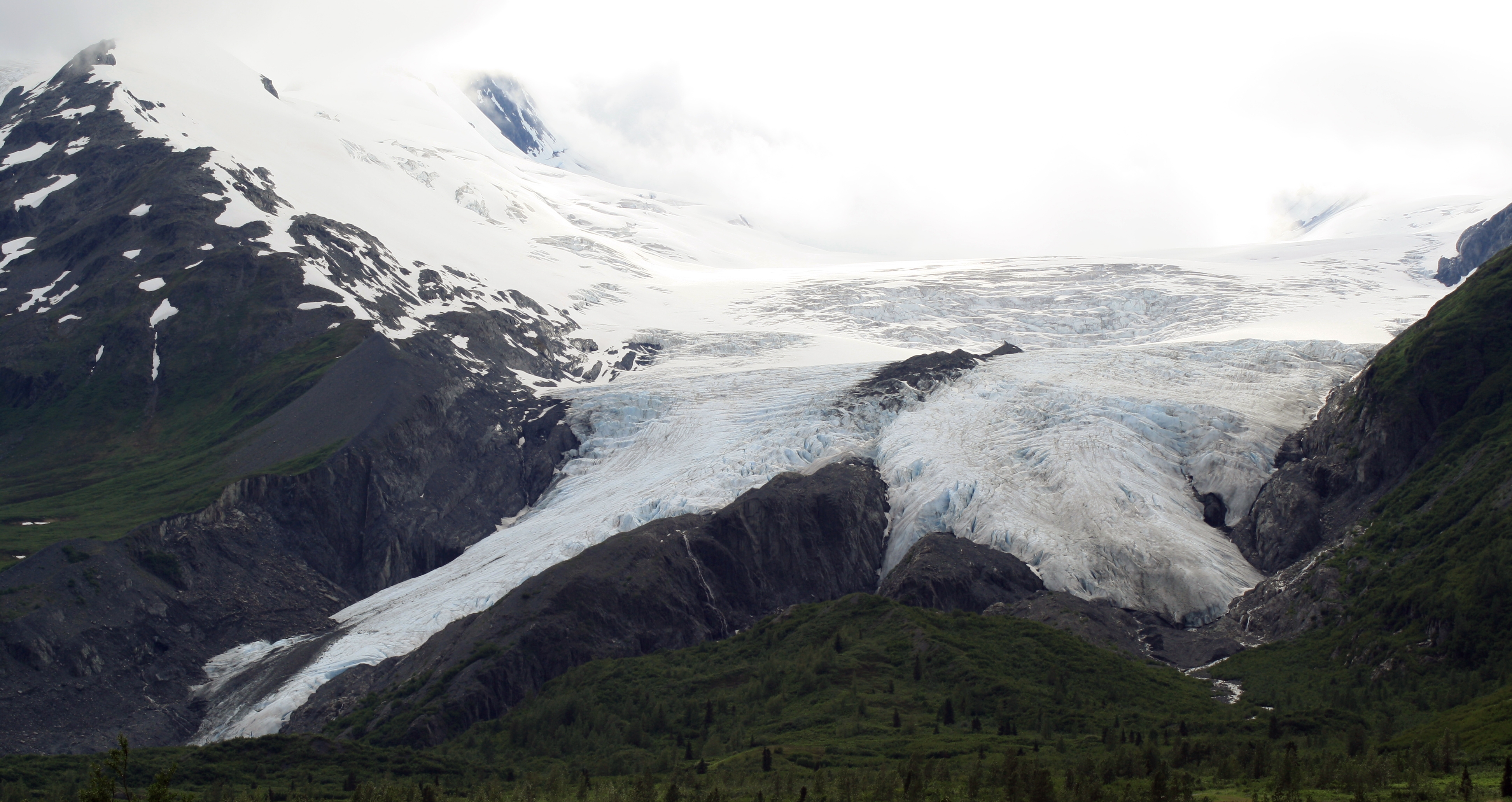
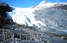
Le glacier Worthington, en anglais Worthington Glacier, est un glacier d'Alaska aux États-Unis qui se trouve près du col Thompson, au sud-est de l'État.
Il est situé sur la Richardson Highway à 46 kilomètres à l'est-nord-est de Valdez et a été inscrit au National Natural Landmark. Il est un des rares glaciers américains à pouvoir être accessible directement depuis la route. Son front glaciaire est divisé en deux digitations dont les eaux donnent naissance à de courts torrents qui alimentent le ruisseau Ptarmigan, un affluent de la rivière Tsina.
Le glacier Worthington à une date inconnue où il était plus avancé qu'aujourd'hui.
Notes et références
Lien externe
Wikimedia Foundation.
2010.
Contenu soumis à la licence CC-BY-SA. Source : Article Glacier Worthington de Wikipédia en français (auteurs)
Regardez d'autres dictionnaires:
Worthington — Cette page d’homonymie répertorie les différents sujets et articles partageant un même nom. Worthington est un patronyme et un toponyme pouvant désigner : Sommaire 1 Patronyme 2 Prénom … Wikipédia en Français
Worthington-Gletscher — Der Worthington Gletscher ist ein Gletscher in den Chugach Mountains in Alaska. Der Worthington Gletscher zeigt viele typische Merkmale eines Talgletschers wie zum Beispiel Ablagerungsgebiete und Endmoränen. Er liegt teilweise in der Worthington… … Deutsch Wikipedia
Mount Worthington — Mount Worthington … Wikipedia
Richardson Highway — La Richardsons Highway est une route d Alaska, aux États Unis, de 562 kilomètres (349 mi), reliant Valdez à Fairbanks. Elle s appelle aussi Alaska Route 4 depuis Valdez jusqu à Delta Junction, et Alaska Route 2 ensuite, jusqu à… … Wikipédia en Français
Liste der National Natural Landmarks in Alaska — Die Liste der National Natural Landmarks in Alaska führt alle geologischen und ökologischen Objekte im US amerikanischen Bundesstaat Alaska auf, die zu National Natural Landmarks erklärt wurden. National Natural Landmarks Name Bild Datum der… … Deutsch Wikipedia
Carlile Pollock Patterson — (1816, Shieldsboro (now named Bay St. Louis), Mississippi – 1881) (his first name is sometimes spelled Carlisle, with an s) was an American civil engineer, superintendent of the United States Coast Survey. The Patterson Glacier, and the Patterson … Wikipedia
Climate of Minnesota — On March 29, 1881 snowdrifts in Minnesota were higher than locomotives. The climate of Minnesota is typical of a continental climate, with cold winters and hot summers. Minnesota s location in the Upper Midwest allows it to experience some of the … Wikipedia
Alaska — This article is about the U.S. state of Alaska. For other uses, see Alaska (disambiguation). Alaskan redirects here. For other uses, see Alaskan (disambiguation). State of Alaska … Wikipedia
Columbus, Ohio — Columbus City … Wikipedia
Old Mine Road — is a road in New Jersey and New York said to be one of the oldest continuously used roads in the United States of America. At a length of 104 miles, it stretches from the Delaware Water Gap National Recreation Area to the vicinity of Kingston,… … Wikipedia
 Pour les articles homonymes, voir Worthington.
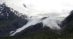
 États-Unis


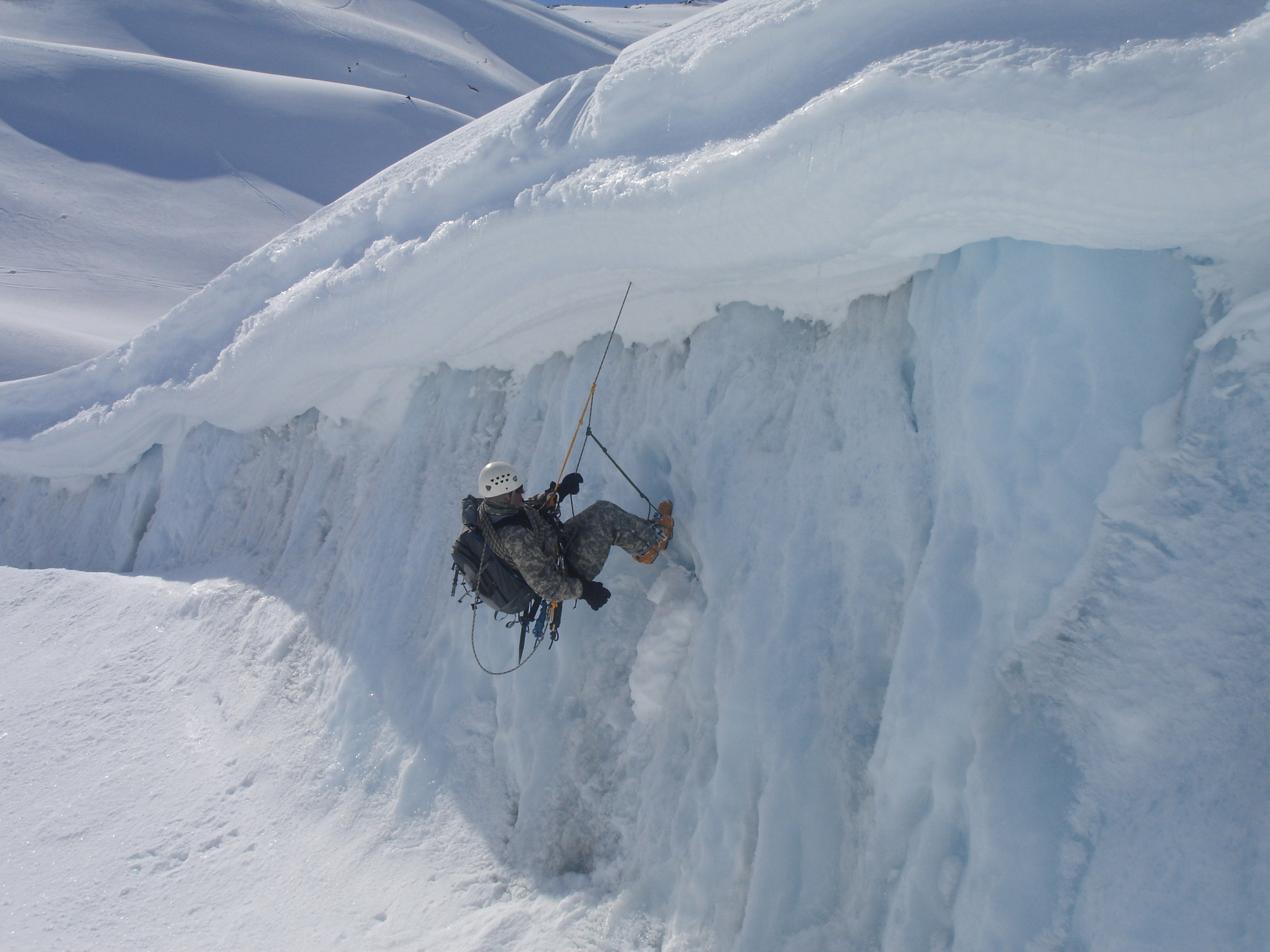
 Escalade glaciaire au glacier Worthington.