Knowsley Road
- Knowsley Road
-
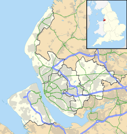
Le Knowsley Road était un stade de rugby anglais situé dans la ville de Saint Helens dans le comté du Merseyside en Angleterre.D'une capacité de 17 500 places, il était le stade officiel de l'équipe de rugby à XIII des St Helens RFC. Ce club évolue au sein du championnat européen de rugby à XIII : la Super League.
Le stade a porté pendant deux ans de 2008 à 2010 le nom de GPW Recruitment Stadium suite à un contrat de naming.
Le stade est actuellement en train d'être démoli pour faire place à un programme de logements appelé Cunningham Grange, du nom de la légende du club Keiron Cunningham.
Wikimedia Foundation.
2010.
Contenu soumis à la licence CC-BY-SA. Source : Article Knowsley Road de Wikipédia en français (auteurs)
Regardez d'autres dictionnaires:
Knowsley Road — Infobox Stadium stadium name = The GPW Recruitment Stadium location = St Helens, Merseyside fullname = The GPW Recruitment Stadium nickname = built = 1890 opened = 1890 seating capacity = 17,500 tenants = St. Helens RFC Knowsley Road, renamed The … Wikipedia
A57 road — UK road routebox road= A57 length mi= length km= direction= West East start= James Street railway station, Liverpool destinations= Warrington Manchester Sheffield end= Lincoln construction date= completion date= junctions= ukroadsmall|1… … Wikipedia
A5300 road — The A5300 or Knowsley Expressway is a trunk road in Merseyside, England. It runs three miles (5 km) from its junction with the A562 to its junction with the M62, where it becomes the M57. Along its course it crosses the Liverpool to Manchester… … Wikipedia
Manchester Liverpool Road railway station — Manchester Liverpool Road The station frontage in 2008. Location Place … Wikipedia
Manchester Oldham Road railway station — Manchester Oldham Road Location Place Manchester Area City of Manchester Grid reference … Wikipedia
Oldfield Road railway station — Oldfield Road Location Place Salford Area City of Salford Coordinates … Wikipedia
Oldham Glodwick Road railway station — Oldham Glodwick Road Location Place Mumps Area Oldham Coordinates … Wikipedia
Manor Road railway station — Manor Road Sign at Manor Road station Location … Wikipedia
Oldham Road railway station (Ashton-under-Lyne) — Oldham Road Railway Station was one of three railway stations that used to serve the town of Ashton under Lyne. The station closed in May 1959 following the withdrawal of passenger services on the line, although the route remained in use for… … Wikipedia
St Helens, Merseyside — For the larger local government district, see Metropolitan Borough of St Helens. Coordinates: 53°27′15″N 2°44′46″W / 53.4541°N 2.7461°W … Wikipedia