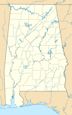
Crossroads (Alabama)
- Crossroads (Alabama)
-
30° 50′ 06″ N 87° 51′ 40″ W / 30.8349084, -87.8611051
Crossroads est une communauté non-incorporée du comté de Baldwin (Alabama).
Elle fait partie de l'aire micropolitaine de Daphne–Fairhope–Foley.
Géographie
La communauté se trouve à une altitude moyenne de 68 mètres[1].
Climat
Relevé météorologique de la station la plus proche de Crossroads
| mois |
jan. |
fév. |
mar. |
avr. |
mai |
jui. |
jui. |
aoû. |
sep. |
oct. |
nov. |
déc. |
année |
| Température minimale moyenne (°C) |
3,3 |
4,4 |
8,3 |
12,2 |
16,7 |
20 |
21,7 |
21,7 |
18,9 |
13,3 |
8,3 |
4,4 |
13 |
| Température moyenne (°C) |
8,9 |
11,1 |
14,4 |
18,3 |
22,2 |
25,6 |
26,7 |
26,7 |
24,4 |
18,9 |
14,4 |
10,6 |
18,5 |
| Température maximale moyenne (°C) |
15 |
17,2 |
21,1 |
24,4 |
28,3 |
31,1 |
31,7 |
31,7 |
29,4 |
25 |
20 |
16,1 |
24,3 |
| Précipitations (mm) |
158 |
130 |
168,1 |
121,2 |
150,4 |
142,7 |
210,1 |
152,4 |
146,3 |
78,2 |
131,6 |
129 |
1 718 |
Record de froid (°C)
(année du record) |
-16,7
(21/01/1985) |
-12,2
(03/02/1951) |
-8,9
(03/03/1980) |
-2,2
(04/04/1987) |
5,6
(07/05/1992) |
10,6
(01/06/1984) |
6,1
(04/07/1964) |
13,3
(14/08/2004) |
5
(29/09/1967) |
-0,6
(31/10/1993) |
-7,2
(25/11/1950) |
-13,9
(24/12/1989) |
-16,7 |
Record de chaleur (°C)
(année du record) |
29,4
(11/01/1949) |
28,9
(27/02/1962) |
31,1
(15/03/1967) |
33,9
(22/04/1987) |
37,8
(31/05/1951) |
40,6
(14/06/1963) |
39,4
(14/07/1980) |
40
(12/08/2007) |
38,9
(10/09/1954) |
35,6
(05/10/1954) |
30
(04/11/1973) |
27,8
(02/12/1982) |
40,6 |
Sources
Références
Compléments
Liens externes
Wikimedia Foundation.
2010.
Contenu soumis à la licence CC-BY-SA. Source : Article Crossroads (Alabama) de Wikipédia en français (auteurs)
Regardez d'autres dictionnaires:
Morrison Crossroads (Alabama) — Morrison Crossroads Lugar designado por el censo de los Estados Unidos … Wikipedia Español
Crossroads of the World — is also a nickname for Times Square in New York City. Crossroads of the World U.S. National Register of Historic Places … Wikipedia
Crossroads School — may mean: Crossroads School (Hoover), in Hoover, Alabama Crossroads School (Santa Monica, California), in Santa Monica, California Crossroads College Preparatory School, a college preparatory school, founded in 1974, for 7th to 12th grade in St.… … Wikipedia
Alabama State Route 166 — Infobox road state=AL type=AL route=166 length mi=5 length ref= [ [http://colepages.com/routes151175.html Highway Route Info Routes 151 175 ] ] length round= established=1972 direction a=West direction b=East starting terminus= at Danleys… … Wikipedia
Alabama State Route 113 — Infobox road state=AL type=AL route=113 length mi=16 length ref= [ [http://colepages.com/routes101125.html Highway Route Info Routes 101 125 ] ] length round= established=1979 direction a=South direction b=North starting terminus= junction= at… … Wikipedia
Alabama State Route 223 — Infobox road state=AL type=AL route=223 alternate name= length mi=26 length round= length ref= [ [http://colepages.com/routes201225.html#ala223 Highway Route Info Routes 201 225 ] ] established= direction a=South direction b=North starting… … Wikipedia
Alabama State Route 225 — Infobox road state=AL type=AL route=225 alternate name= length mi=24 length round= length ref= [ [http://colepages.com/routes201225.html#ala225 Highway Route Info Routes 201 225 ] ] established= direction a=South starting terminus= junction=… … Wikipedia
Alabama State Route 20 — Infobox road state=AL type=AL route=20 length mi=84 length ref= [ [http://colepages.com/routes125.html Highway Route Info Routes 1 25 ] ] length round= established= direction a=West direction b=East starting terminus= junction=Natchez Trace… … Wikipedia
Alabama State Route 102 — Infobox road state=AL type=AL route=102 length mi=24 length ref= [ [http://colepages.com/routes101125.html Highway Route Info Routes 101 125 ] ] length round= established=1962 direction a=West direction b=East starting terminus= junction= ending… … Wikipedia
Sand Mountain (Alabama) — Plateau Sand Mountain in Alabama Country … Wikipedia
 États-Unis
 Alabama