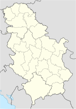
Crnokosa
- Crnokosa
-
Le mont Crnokosa (en serbe cyrillique : Црнокоса) est une montagne du sud-ouest de la Serbie. Son point culminant s'élève une altitude de 810 m.
Géographie
Le mont Crnokosa est situé à proximité de la ville de Kosjerić. Sur 9 km, il longe le Skrapež, formant un canyon sur la partie méridionale de cette rivière ; le sud de cette montagne se caractérise par des pentes plus douces[2].
Notes et références
Voir aussi
Articles connexes
Catégories : - Sommet de Serbie
- Sommet des Alpes dinariques
Wikimedia Foundation.
2010.
Contenu soumis à la licence CC-BY-SA. Source : Article Crnokosa de Wikipédia en français (auteurs)
Regardez d'autres dictionnaires:
Crnokosa — Crnokosa … Wikipedia
Kosjerić — Косјерић Héraldique … Wikipédia en Français
Suzana Ćebić — Suzana Ćebić … Wikipédia en Français
Željko Joksimović — Infobox musical artist Name = Željko Joksimović Жељко Јоксимовић Img capt = Željko Joksimović Img size = 150px Landscape = Background = solo singer Birth name = Alias = Born = Birth date and age|1972|4|20|mf=y Died = Origin = Belgrade, Serbia,… … Wikipedia
List of mountains in Serbia — This is the full list of mountains in Serbia (including Kosovo).[a] Most of Serbia is covered with low and medium high mountains. Mountains in central, western and southwestern Serbia belong to the Dinarides range, while the Carpates, Balkan… … Wikipedia
Đetinja — (Ђетиња) The river Đetinja as it runs through the city of Užice Origin Zlatibor, western Serbia Mouth with … Wikipedia
Golijska Moravica — Infobox River | river name = Golijska Moravica (Голијска Моравица) caption = origin = Golija mountain, northeast of Sjenica, Serbia mouth = with the Đetinja forms the Zapadna Morava, east of Požega, Serbia basin countries = Serbia length = 98 km… … Wikipedia
Ima nešto u tom što me nećeš — Infobox Album Name = Ima nešto u tom što me nećeš Type = studio Longtype = Artist = Željko Joksimović Released = 2005 Recorded = Genre = Pop Length = Label = Producer = Reviews = Last album = This album = Next album = Ima nešto u tom što me nećeš … Wikipedia
Detinja — Đetinja la Đetinja La Đetinja à Užice Caractéristiques Longueur 75 km Bassin … Wikipédia en Français
Golijska Moravica — Pour les articles homonymes, voir Moravica. la Golijska Moravica Caractéristiques Longueur … Wikipédia en Français

 Serbie

