Chinnor
- Chinnor
-
51° 42′ 07″ N 0° 54′ 40″ W / 51.702, -0.911

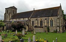
L'
église paroissiale Saint-
André.
Chinnor est un village et une paroisse civile de l'Oxfordshire, en Angleterre. Il est situé dans le district du South Oxfordshire, au sud-est de Thame. La paroisse, qui inclut également les villages d'Emmington, Henton et Oakley, comptait 5 857 habitants au moment du recensement de 2001.
Sur les autres projets Wikimedia :
Wikimedia Foundation.
2010.
Contenu soumis à la licence CC-BY-SA. Source : Article Chinnor de Wikipédia en français (auteurs)
Regardez d'autres dictionnaires:
Chinnor F.C. — Chinnor Full name Chinnor Football Club Nickname(s) The Biz Ground Station Road, Playing Fields … Wikipedia
Chinnor R.F.C. — Chinnor Rugby Football Club is a rugby union club founded in Thame, Oxfordshire, England in 1963. They are currently playing in the National Division Three South. History Chinnor gained promotion to the National Leagues in 2006 and became the… … Wikipedia
Chinnor — Coordinates: 51°42′07″N 0°54′40″W / 51.702°N 0.911°W / 51.702; 0.911 … Wikipedia
Chinnor — Original name in latin Chinnor Name in other language Chinnor State code GB Continent/City Europe/London longitude 51.70177 latitude 0.91161 altitude 120 Population 5527 Date 2010 08 03 … Cities with a population over 1000 database
Chinnor and Princes Risborough Railway — Pannier Tank at Chinnor Station 5700 class Pannier tank 9682 waits while passengers board at Chinnor Station on the preserved Chinnor and Princes Risborough Railway Locale Buckinghamshir … Wikipedia
Chinnor railway station — Chinnor Chinnor railway station in 2008 Location Place Chinnor … Wikipedia
Chiltern Main Line — Chiltern Railways Clubman at West Ruislip Overview Type Commuter rail, Heavy rail S … Wikipedia
Adam Clayton — Infobox musical artist | Name = Adam Clayton Img capt = Clayton playing a Lakland bass on 2 July, 2005 in Vienna, Austria (Vertigo Tour) Img size = 220 Background = non vocal instrumentalist Birth name = Alias = Sparky Born = Birth date and… … Wikipedia
Oakley, Oxfordshire — Coordinates: 51°41′56″N 0°55′08″W / 51.699°N 0.919°W / 51.699; 00.919 … Wikipedia
Chiselhampton — Coordinates: 51°41′06″N 1°08′35″W / 51.685°N 1.143°W / 51.685; 1.143 … Wikipedia

