Checotah
- Checotah
-
Wikimedia Foundation.
2010.
Contenu soumis à la licence CC-BY-SA. Source : Article Checotah de Wikipédia en français (auteurs)
Regardez d'autres dictionnaires:
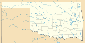
Checotah — Lage in Oklahoma Basisdaten Staat: Vereinigte Staaten … Deutsch Wikipedia
Checotah — Checotah, OK U.S. city in Oklahoma Population (2000): 3481 Housing Units (2000): 1576 Land area (2000): 8.941356 sq. miles (23.158005 sq. km) Water area (2000): 0.063743 sq. miles (0.165093 sq. km) Total area (2000): 9.005099 sq. miles (23.323098 … StarDict's U.S. Gazetteer Places
Checotah, OK — U.S. city in Oklahoma Population (2000): 3481 Housing Units (2000): 1576 Land area (2000): 8.941356 sq. miles (23.158005 sq. km) Water area (2000): 0.063743 sq. miles (0.165093 sq. km) Total area (2000): 9.005099 sq. miles (23.323098 sq. km) FIPS … StarDict's U.S. Gazetteer Places
Checotah — Original name in latin Checotah Name in other language State code US Continent/City America/Chicago longitude 35.4701 latitude 95.52304 altitude 201 Population 3335 Date 2011 05 14 … Cities with a population over 1000 database
Checotah, Oklahoma — City Kniseley and Long Building … Wikipedia
Checotah (Oklahoma) — Checotah Ciudad de los Estados Unidos Ubicación en el condado de McInto … Wikipedia Español
Americas Best Value Inn - Checotah — (Checotah,США) Категория отеля: 2 звездочный отель Адрес: 1212 West Gentry … Каталог отелей
Oklahoma Odd Fellows Home at Checotah — U.S. National Register of Historic Places … Wikipedia
74426 — Checotah, Ok (Miscellaneous » ZIP Codes) … Abbreviations dictionary
National Register of Historic Places listings in McIntosh County, Oklahoma — Location of McIntosh County in Oklahoma This is a list of the National Register of Historic Places listings in McIntosh County, Oklahoma. This is intended to be a complete list of the properties and districts on the National Register of Historic… … Wikipedia
 États-Unis
 Oklahoma