Bzenica
Contenu soumis à la licence CC-BY-SA. Source : Article Bzenica de Wikipédia en français (auteurs)
Regardez d'autres dictionnaires:
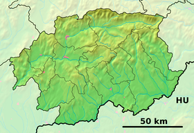
Bzenica — Bzencia ( de. Senitz; hu. Szénásfalu) is a village and municipality in Žiar nad Hronom District in the Banská Bystrica Region of central Slovakia.HistoryThe village was first mentioned in old charters in 1326 ( Bezenche ) as belonging to Levice… … Wikipedia
Banská Bystrica Region — Geobox | Region name = Banská Bystrica other name = category = Region image caption = image caption = symbol = symbol type = Coat of arms etymology = official name = motto = nickname = country = Slovakia country state = region = district =… … Wikipedia
Dolná Ves — Coordinates: 48°39′56″N 18°54′45″E / 48.66556°N 18.9125°E / 48.66556; 18.9125 … Wikipedia
Rasina River — The Rasina (Serbian Cyrillic: Расина) is a river in south central Serbia. The 92 km long river flows through the Rasina region, gives its name to the modern Rasina District of Serbia, and flows into the Zapadna Morava near the city of… … Wikipedia
Žiar nad Hronom District — District Country Slovakia Region … Wikipedia
Andrej Kmeť — (November 19, 1841, Bzenica February 16, 1908, Turčiansky Svätý Martin) was a Slovak botanist, ethnographer, archaeologist, and geologist. He identified several new species of plants and created a herbarium with 72,000 specimens. He was one of… … Wikipedia
Dolná Trnávka — Žiar nad Hronom District in the Banská Bystrica Region Dolná Trnávka (Hungarian: Alsótárnok) is a village and municipality in Žiar nad Hronom District in the Banská Bystrica Region of central Slovakia. History In … Wikipedia
List of municipalities and towns in Slovakia — Slovakia This is a comprehensive list of municipalities and towns in Slovakia. For lists of towns and municipalities sorted by Regions see the individual articles on Regions. For an outdated list of towns only in Slovakia see also List of towns… … Wikipedia
Dolná Ždaňa — Žiar nad Hronom District in the Banská Bystrica Region Dolná Ždaňa is a village and municipality in Žiar nad Hronom District in the Banská Bystrica Region of central Slovakia. History In historical records, the village was first mentioned in 1391 … Wikipedia
Nevoľné — Žiar nad Hronom District in the Banská Bystrica Region of Slovakia Nevoľné is a village and municipality in Žiar nad Hronom District in the Banská Bystrica Region of central Slovakia, 6 kilometres from Kremnica town. The village is mentioned… … Wikipedia
 Slovaquie


