Bystričany
- Bystričany
-
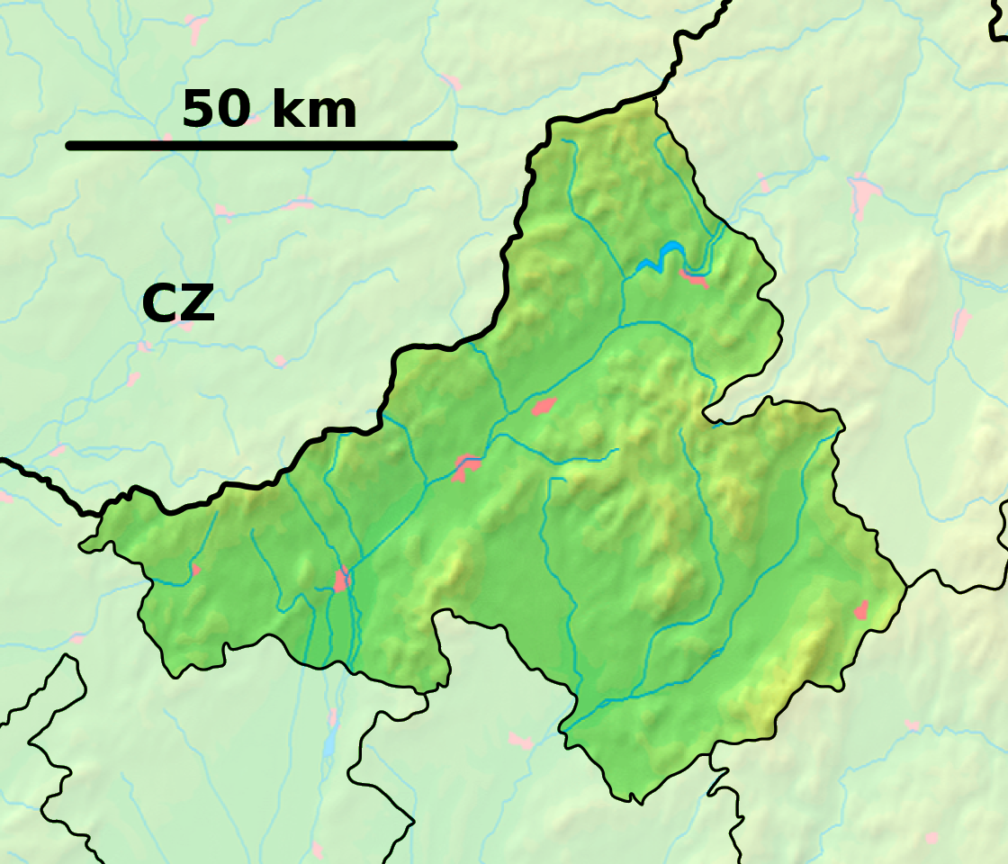
Bystričany (allemand : Bistrizin, hongrois : Besztercsény)[4] est un village de Slovaquie situé dans la région de Trenčín.
Histoire
La première mention écrite du village date de 1388[2].
Notes et références
Catégories : - Village de Slovaquie
- Village et ville du district de Prievidza
Wikimedia Foundation.
2010.
Contenu soumis à la licence CC-BY-SA. Source : Article Bystričany de Wikipédia en français (auteurs)
Regardez d'autres dictionnaires:
Bystričany — Wappen Karte … Deutsch Wikipedia
Bystričany — is a village and municipality in Prievidza District in the Trenčín Region of western Slovakia.HistoryIn historical records the village was first mentioned in 1388.GeographyThe municipality lies at an altitude of 260 metres and covers an area of… … Wikipedia
Branislav Obžera — Branislav Obžera Spielerinformationen Geburtstag 29. August 1981 Geburtsort Bystričany, Tschechoslowakei Position Mittelfeld Vereine in der Jugend … Deutsch Wikipedia
Malinová — Location of Prievidza District in the Trenčín Region Malinová (German: Zeche, Hungarian: Csék) is a village and municipality in Prievidza District in the Trenčín Region of western Slovakia. It lies about 15 km north of the town of Prievidza … Wikipedia
Nitrianske Pravno — Coordinates: 48°52′00″N 18°38′00″E / 48.8666667°N 18.6333333°E / 48.8666667; 18.6333333 … Wikipedia
Trenčín Region — Geobox | Region name = Trenčín other name = category = Region image caption = image caption = symbol = Trencin coat of arms.gif symbol type = Coat of arms etymology = official name = motto = nickname = country = Slovakia country state = region =… … Wikipedia
Prievidza District — District Country Slovakia Region … Wikipedia
Nová Lehota — (German: Neuhau) is a village and municipality in Prievidza District in the Trenčín Region of western Slovakia. Since 1976 it has been a part of the municipality of Handlová. History In historical records the village was first mentioned in 1487.… … Wikipedia
List of municipalities and towns in Slovakia — Slovakia This is a comprehensive list of municipalities and towns in Slovakia. For lists of towns and municipalities sorted by Regions see the individual articles on Regions. For an outdated list of towns only in Slovakia see also List of towns… … Wikipedia
Handlová — Coordinates: 48°43′38″N 18°45′43″E / 48.72722°N 18.76194°E / 48.72722; 18.76194 … Wikipedia
 Slovaquie
 Bystričany