Bergen Neck
Contenu soumis à la licence CC-BY-SA. Source : Article Bergen Neck de Wikipédia en français (auteurs)
Regardez d'autres dictionnaires:
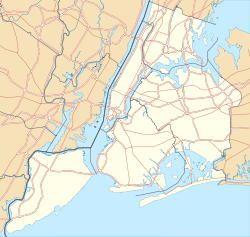
Bergen Neck — is an antiquated name for the penisula between the Upper New York Bay and the Newark Bay in Hudson County, New Jersey municpalities of Bayonne and Jersey City. This long narrow strip of land begins on the Kill van Kull at its southernmost tip,… … Wikipedia
Bergen, New Netherland — Bergen was a part of the 17th century province of New Netherland, in the area in northeastern New Jersey along the Hudson and Hackensack Rivers that would become contemporary Hudson and Bergen Counties. Though it only officially existed from 1661 … Wikipedia
Bergen Hill, Jersey City — For lower Hudson Palisades, see: Bergen Hill. Bergen Hill the name given to the emergence of the Hudson Palisades along the Bergen Neck peninsula in Hudson County, New Jersey and the inland neighborhood of the Jersey City where they rise from the … Wikipedia
New Barbadoes Neck — is between the Hackensack and Passaic Rivers New Barbadoes Neck is the name given in the colonial era for the peninsula in northeastern New Jersey, USA between the lower Hackensack and Passaic Rivers, in what is now western Hudson County and… … Wikipedia
Toponymy of Bergen, New Netherland — Placenames in the 17th century province of Bergen, New Netherland (in what is now northeastern New Jersey), in most cases had their roots in Dutch and Algonquian language Lenape. At the time of European settlement it was the territory of the… … Wikipedia
North Bergen, New Jersey — Township Seal … Wikipedia
Old Bergen Church — U.S. National Register of Historic Places New Jersey Register of Historic Places … Wikipedia
Colts Neck Township, New Jersey — Township Map of Colts Neck Township in Monmouth County. Inset: Location of Monmouth County highlighted in the State of New Jersey … Wikipedia
Colts Neck School District — Superintendent: Ross E. Kasum Business Administrator: John Paredes Address: 70 Conover Road Colts Neck, NJ 07722 Grade Range … Wikipedia
Greenville, Jersey City — For other places with the same name, see Greenville (disambiguation). Greenville is located between the Newark Bay and Upper New York Bay Greenville is the southernmost section of Jersey City, New Jersey.[1] … Wikipedia