Beitstadfjord
- Beitstadfjord
-
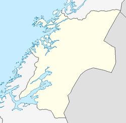
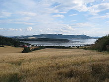
Le Beitstadfjord (Beitstadfjorden) est un fjord norvégien. Il s'agit du bras le plus à l'intérieur des terres du Trondheimsfjord, qui débouche dans la mer de Norvège.
Il se situe sur les municipalités de Steinkjer, Inderøy, Verran et Mosvik. Le fjord mesure 28 km de long, du Sud-Ouest au Nord-Est, et jusqu'à 8 km de large. Le fjord commence au détroit de Skarn au Sud et s'étend vers le Nord-Est jusqu'à la ville de Steinkjer.
Wikimedia Foundation.
2010.
Contenu soumis à la licence CC-BY-SA. Source : Article Beitstadfjord de Wikipédia en français (auteurs)
Regardez d'autres dictionnaires:
Fiordo de Trondheim — (Trondheimsfjorden) Vista del fiordo Åsenfjord, un ramal interior del Trondheimsfjord cerca de Stjørdal Ubicación geográfica … Wikipedia Español
Verran — kommune Municipality View from Malm at sunset … Wikipedia
Inderøy — kommune Municipality … Wikipedia
Trondheimsfjord — The Beitstadfjord might also freeze over in winter, but only for a few weeks.The towns Stjørdal, Levanger and Steinkjer are found on the eastern and northeastern shore of the fjord. Aker Verdal in Verdal produces large offshore installations for… … Wikipedia
Follafoss — is a village in the county of Nord Trøndelag, Norway, located in the middle of the Trondheimsfjord, in the Beitstadfjord fjord inlet.Zip code: 7796Population: 450 (2004)External links* [http://www.miljolare.no/data/ut/omrade/?o id=563] … Wikipedia
List of Norwegian fjords (by geographic locations) — The Lysefjord as seen from Mount Kjerag The … Wikipedia
Skarnsund — is a sound in Trondheimsfjord connecting the inner section, Beitstadfjord, with the outer section. Skarnsund is about half a kilometer wide with Inderøy to the east and Mosvik to the west.Prior to December 19, 1991 the sound was crossed by a car… … Wikipedia
Auswahl von Fjorden — Diese Liste stellt eine Auswahl von Fjorden dar, unterteilt nach Ländern. Inhaltsverzeichnis 1 Europa 2 Dänemark 2.1 Deutschland 2.2 Norwegen 2.3 Spitzbergen 2.4 … Deutsch Wikipedia
Liste der Fjorde — Diese Liste stellt eine Auswahl von Fjorden dar, unterteilt nach Ländern. Inhaltsverzeichnis 1 Europa 2 Dänemark 2.1 Deutschland 2.2 Norwegen 2.3 Spitzbergen 2.4 … Deutsch Wikipedia
Liste von Fjorden — Diese Liste stellt eine Auswahl von Fjorden dar, unterteilt nach Ländern. Inhaltsverzeichnis 1 Europa 1.1 Dänemark 1.2 Deutschland 1.3 Norwegen … Deutsch Wikipedia
 Norvège


