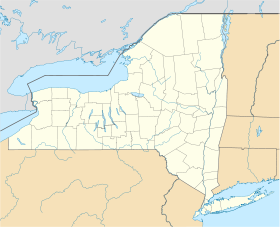
Arden (New York)
Contenu soumis à la licence CC-BY-SA. Source : Article Arden (New York) de Wikipédia en français (auteurs)
Regardez d'autres dictionnaires:
Arden, New York — Arden, is a hamlet around the town line of Tuxedo and Monroe, New York, in the United States. It is roughly coterminous with the 10910 ZIP Code.The area was originally known as Greenwood, and was noted for the iron works belonging to Robert and… … Wikipedia
New York - New Jersey Trail Conference — The New York New Jersey Trail Conference (NYNJTC) is a federation of approximately 10,000 individual members and about 100 member organizations (mostly hiking clubs and environmental organizations). Purpose of organization The Trail Conference is … Wikipedia
New York City Subway — Top: A number 4 train made up of R142 … Wikipedia
New Windsor, New York — Town … Wikipedia
New York State Route 17 — NY 17 redirects here. NY 17 may also refer to New York s 17th congressional district. NYS Route 17 Map of New York with NY 17 highlighted in red … Wikipedia
New York State Route 440 — NYS Route 440 Route information Maintained by NYSDOT and PANYNJ Length: 12.73 mi … Wikipedia
New York congestion pricing — Traffic at a red signal on Second Avenue in Manhattan. New York congestion pricing was a proposed traffic congestion fee for vehicles traveling into or within the Manhattan central business district of New York City. The congestion pricing char … Wikipedia
New Windsor (CDP), New York — Coordinates: 41°29′15″N 74°01′08″W / 41.4875°N 74.01889°W / 41.4875; 74.01889 … Wikipedia
New York City Farm Colony — The New York City Farm Colony was a poorhouse on the New York City borough of Staten Island, one of the city s five boroughs. It was located across Brielle Avenue from Sea View Hospital, on the edge of the Staten Island Greenbelt … Wikipedia
New Hampton, New York — Central New Hampton, along routes 6 and 17M. New Hampton is a small hamlet in the Town of Wawayanda in Orange County, New York, USA. It is just outside the city of Middletown, across Interstate 84 along US 6 and NY 17M. It has the ZIP Code 10958 … Wikipedia
 Pour les articles homonymes, voir Arden.
 États-Unis
 New York