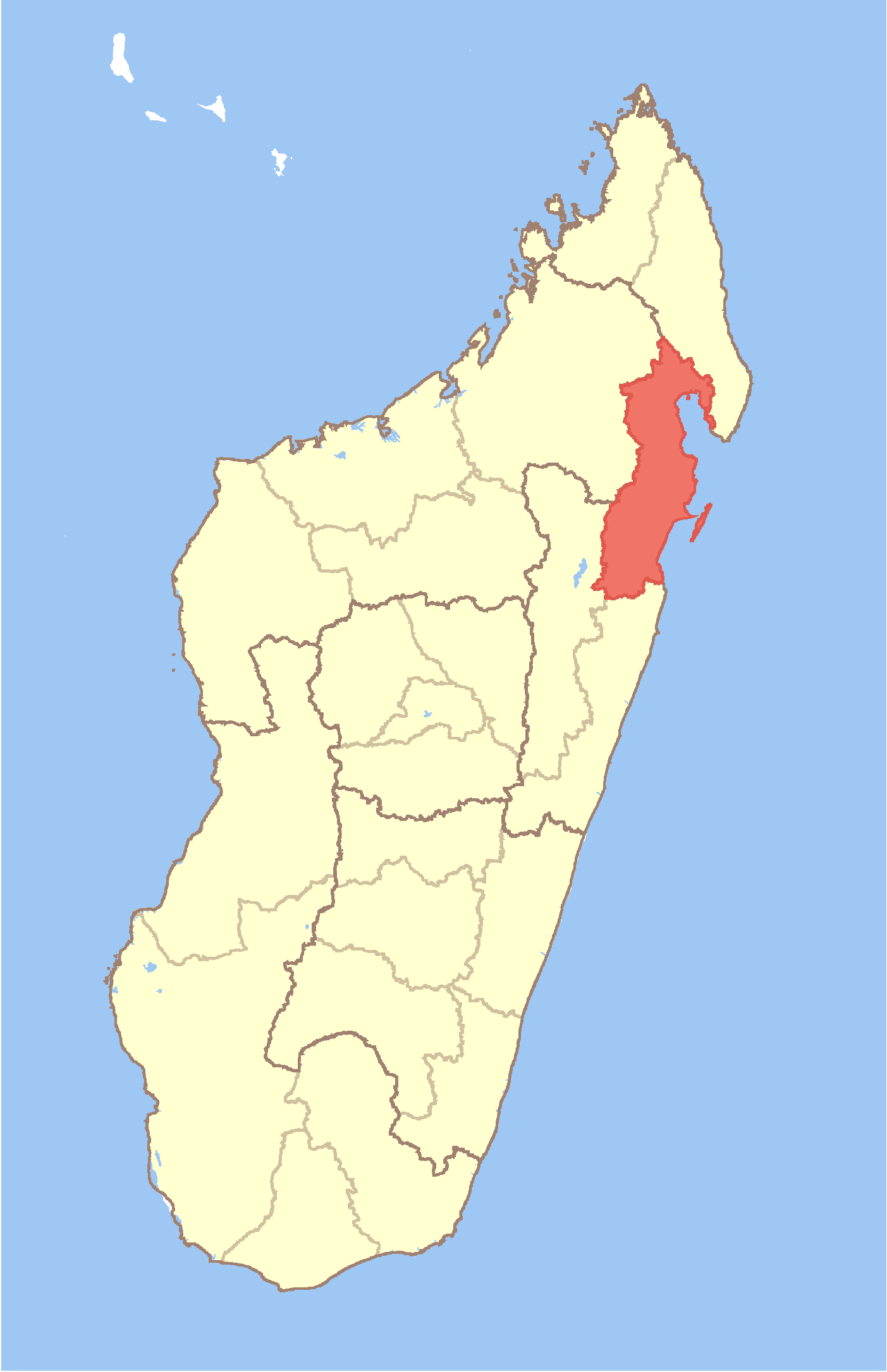
Ambodimanga II
Contenu soumis à la licence CC-BY-SA. Source : Article Ambodimanga II de Wikipédia en français (auteurs)
Regardez d'autres dictionnaires:
Ambodimanga — may mean several communes in Madagascar: * Ambodimanga in Ambanja District, Antsiranana Province. * Ambodimanga in Andapa District, Antsiranana Province. * Ambodimanga II in Fenerive Est District, Toamasina Province … Wikipedia
Ambodimanga II — Infobox Settlement official name = Ambodimanga II other name = native name = nickname = settlement type = motto = imagesize = image caption = flag size = image seal size = image shield = shield size = image blank emblem = blank emblem type =… … Wikipedia
Ambodimanga, Ambanja — Infobox Settlement official name = Ambodimanga other name = native name = nickname = settlement type = motto = imagesize = image caption = flag size = image seal size = image shield = shield size = image blank emblem = blank emblem type = blank… … Wikipedia
Ambodimanga (Ambanja) — 13°47′S 48°37′E / 13.783, 48.617 … Wikipédia en Français
Ambodimanga, Andapa — Infobox Settlement official name = Ambodimanga other name = native name = nickname = settlement type = motto = imagesize = image caption = flag size = image seal size = image shield = shield size = image blank emblem = blank emblem type = blank… … Wikipedia
Ambodimanga (Andapa) — 14° 28′ S 49° 20′ E / 14.46, 49.33 … Wikipédia en Français
District d'Ambanja — 13°40′43″S 48°27′08″E / 13.67861, 48.45222 … Wikipédia en Français
District d'Andapa — 14°39′S 49°39′E / 14.65, 49.65 … Wikipédia en Français
Province de Tamatave — 17°45′S 48°45′E / 17.75, 48.75 Pr … Wikipédia en Français
Antsiranana — (Malagasy: Antsiran̈ana Malagasy pronunciation: [antsʲˈraŋanə̥]), named Diego Suarez prior to 1975, is a city at the northern tip of Madagascar. Antsiranana is the capital of Diana Region. Contents 1 … Wikipedia
 Madagascar