Almásfüzitő
- Almásfüzitő
-
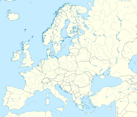
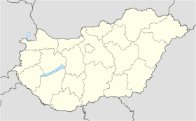
Almásfüzitő est un village et une commune du comitat de Komárom-Esztergom en Hongrie.
Géographie
Cette section est vide, insuffisamment détaillée ou incomplète.
Votre aide est la bienvenue !
Histoire
Cette section est vide, insuffisamment détaillée ou incomplète.
Votre aide est la bienvenue !
Catégorie :
- Ville et village du comitat de Komárom-Esztergom
Wikimedia Foundation.
2010.
Contenu soumis à la licence CC-BY-SA. Source : Article Almásfüzitő de Wikipédia en français (auteurs)
Regardez d'autres dictionnaires:
Almásfüzitő — [ ɔlmaːʃfyzitøː], Gemeinde im Bezirk Komárom Esztergom, Ungarn, an der Donau, 2 500 Einwohner; Wirtschaft: größte Tonerdefabrik Ungarns, Erdölraffinerie, bedeutende chemische Industrie … Universal-Lexikon
Almásfüzitő — Infobox Settlement subdivision type = Country subdivision name = HUN timezone=CET utc offset=+1 timezone DST=CEST utc offset DST=+2|official name=Almásfüzitő subdivision type1=County subdivision name1=Komárom Esztergom area total km2=8.19… … Wikipedia
Almasfüzitő — Sp Álmašfiuzitė Ap Almasfüzitő L Vengrija … Pasaulio vietovardžiai. Internetinė duomenų bazė
Almasfuzito — Original name in latin Almsfzit Name in other language Kiskolonia, Kiskolnia State code HU Continent/City Europe/Budapest longitude 47.72752 latitude 18.26153 altitude 112 Population 2348 Date 2012 02 23 … Cities with a population over 1000 database
Oil Campaign chronology of World War II — Main articles: Oil Campaign of World War II and Oil Campaign targets of World War II The Oil Campaign chronology of World War II lists bombing missions and related events regarding the petroleum/oil/lubrication (POL) facilities that supplied Nazi … Wikipedia
Liste der Limeskastelle in Ungarn — Der pannonische Limes Die Liste der Limeskastelle in Ungarn umfasst römische Militärlager, denen die Kontrolle und Verteidigung der Außengrenze der römischen Provinz Pannonien (Pannonia) im Bereich des heutigen ungarischen Staates oblag. Die… … Deutsch Wikipedia
Ligne Esztergom — Almásfüzitő La Gare d Esztergom. Pays Hongr … Wikipédia en Français
Ligne d'Esztergom à Komárom — Ligne Esztergom Komárom La Gare d Esztergom. Pays Hongrie … Wikipédia en Français
List of rail accidents (2000–present) — List of rail accidents from 2000 to the present. The list includes some terrorist bombings. For accidents before 1950, see List of pre 1950 rail accidents .For accidents between 1950 and 1999 (inclusive), see List of 1950 1999 rail accidents .For … Wikipedia
Komárom-Esztergom County — Infobox Hungarian county name =Komárom Esztergom region =Central Transdanubia seat = Tatabánya area = 2265 population = 319,000 density = 142 cities = 76Komárom Esztergom is the name of an administrative county (comitatus or megye) in northern… … Wikipedia

 Hongrie


