Aguijan
- Aguijan
-
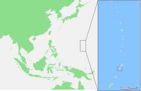
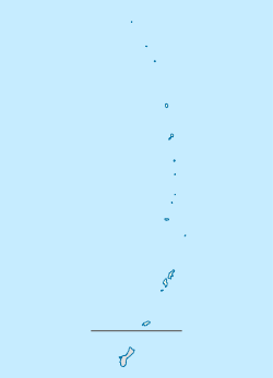
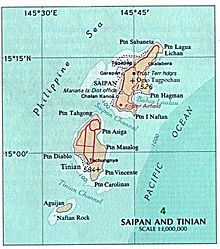
Aguijan est une île coralienne inhabitée des îles Mariannes du Nord. Elle fait partie de la municipalité de Tinian (en)[1].
Huit kilométres au nord se rencontre les îles de Tinian (dont elle est séparée par le Tinian channel) et Tatsumi Reef et deux kilométres au sud se trouve Naftan Rock.
Liens externes
Notes
Wikimedia Foundation.
2010.
Contenu soumis à la licence CC-BY-SA. Source : Article Aguijan de Wikipédia en français (auteurs)
Regardez d'autres dictionnaires:
Aguijan — is a small bean shaped coralline island in the Northern Mariana Islands chain situated 8 km southwest of Tinian. It is only 7.09 km² (2.738 sq mi) in size and is nicknamed Goat Island due to the large number of feral goats present there. Much of… … Wikipedia
Aguijan — Lage von Aguijan (Aguiguan) im südlichen Bereich der Nördlichen Marianen Gewässer Pa … Deutsch Wikipedia
Aguijan — Mapa de las islas Saipán, Tinian y Aquijan. Aguijan es una pequeña isla de las Islas Marianas del Norte situada a 8 km de Tinian, isla separada por el Canal de Tinian. Tiene 7,09 km ² (2,738 millas cuadradas) en tamaño y es apodado Goat Island,… … Wikipedia Español
Aguijan Island — Admin ASC 2 Code Orig. name Aguijan Island Country and Admin Code MP.120.7755008 MP … World countries Adminstrative division ASC I-II
Aguiguan — Aguijan Lage von Aguijan (Aguiguan) im südlichen Bereich der Nördlichen Marianen Gewässer Pazifischer Ozean … Deutsch Wikipedia
Golden White-eye — Conservation status … Wikipedia
Northern Mariana Islands — This article is about the Commonwealth of the Northern Mariana Islands. For the Mariana Archipelago, see Mariana Islands. Commonwealth of the Northern Mariana Islands Sankattan Siha Na Islas Mariånas … Wikipedia
Mariana Islands — For other uses, see Mariana. Mariana Islands at map right, east of the Philippine Sea, and just west of the Mariana Trench in the ocean floor. The Mariana Islands (also the Marianas; up to the early 20th century sometimes called Ladrones Islands … Wikipedia
Diebesinseln — In diesem Artikel oder Abschnitt fehlen folgende wichtige Informationen: Geographie Du kannst Wikipedia helfen, indem du sie recherchierst und einfügst … Deutsch Wikipedia
Diebsinseln — In diesem Artikel oder Abschnitt fehlen folgende wichtige Informationen: Geographie Du kannst Wikipedia helfen, indem du sie recherchierst und einfügst … Deutsch Wikipedia
 Îles Mariannes du Nord
 Îles Mariannes du Nord


