Banský Studenec
- Banský Studenec
-
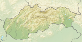
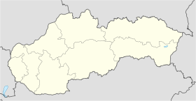
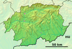
Banský Studenec (allemand : Kohlbach bei Schemnitz ,hongrois : Tópatak) est un village de Slovaquie situé dans la région de Banská Bystrica.
Histoire
Première mention écrite du village en 1266.
Notes et références
Catégories : - Village de Slovaquie
- Village et ville du district de Banská Štiavnica
Wikimedia Foundation.
2010.
Contenu soumis à la licence CC-BY-SA. Source : Article Banský Studenec de Wikipédia en français (auteurs)
Regardez d'autres dictionnaires:
Banský Studenec — Wappen Karte … Deutsch Wikipedia
Banský Studenec — ( de. Kohlbach, Goldbach; hu. Tópatak) is a village and municipality in Banská Štiavnica District, in the Banská Bystrica Region of Slovakia.HistoryIn historical records, the village was first mentioned in 1266 ( Kulpach ) as a German settlement … Wikipedia
Tajchy — Ciudad histórica de Banská Štiavnica y monumentos técnicos de los alrededores1 Patrimonio de la Humanidad Unesco Plaza de la Trinidad … Wikipedia Español
List of municipalities and towns in Slovakia — Slovakia This is a comprehensive list of municipalities and towns in Slovakia. For lists of towns and municipalities sorted by Regions see the individual articles on Regions. For an outdated list of towns only in Slovakia see also List of towns… … Wikipedia
Liste deutscher Bezeichnungen slowakischer Orte — In dieser Liste werden slowakischen Orten (Städte, Flüsse, Gebirge, etc.) deren deutsche Bezeichnungen gegenübergestellt, die sie aus deutschsprachiger Sicht heute noch tragen oder zu Zeiten trugen, als die Gebiete zur Donaumonarchie gehörten.… … Deutsch Wikipedia
Banská Bystrica Region — Geobox | Region name = Banská Bystrica other name = category = Region image caption = image caption = symbol = symbol type = Coat of arms etymology = official name = motto = nickname = country = Slovakia country state = region = district =… … Wikipedia
Banská Štiavnica District — Infobox Slovak district subject name = Banská Štiavnica District region district slovak region = Banská Bystrica Region population = 17,092 (2001) prefix = 45 area = 292 car plate = BS image location = Okres stiavnica.png Banská Štiavnica… … Wikipedia
Dekýš — Coordinates: 48°24′N 18°46′E / 48.4°N 18.767°E / 48.4; 18.767 … Wikipedia
Močiar — is a village and municipality in Banská Štiavnica District, in the Banská Bystrica Region of Slovakia. v · Banská Štia … Wikipedia
Antol — Svätý Anton Wappen Karte … Deutsch Wikipedia
 Slovaquie


