Željin
- Željin
-
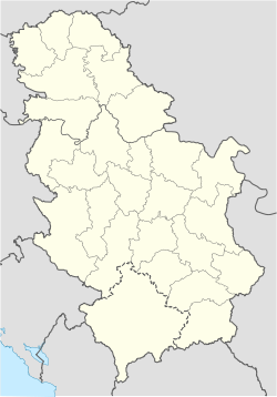
Le mont Željin (en serbe cyrillique : Жељин) est une montagne du centre-sud de la Serbie. Il s'élève à une altitude de 1 785 m[1]. Il est situé au centre-sud du pays.
Notes et références
Voir aussi
Articles connexes
Wikimedia Foundation.
2010.
Contenu soumis à la licence CC-BY-SA. Source : Article Željin de Wikipédia en français (auteurs)
Regardez d'autres dictionnaires:
Zeljin — Željin Željin Géographie Altitude 1 785 m[1 … Wikipédia en Français
Zeljin — (Scheljin, Zelin), einer der höchsten Berge Serbiens, 1844 m hoch, nördlich vom Kopaonikgebirge und östlich vom Ibarfluß … Meyers Großes Konversations-Lexikon
Željin — Sp Žèlinas Ap Жељин/Željin L k. Serbijoje … Pasaulio vietovardžiai. Internetinė duomenų bazė
List of mountains in Serbia — This is the full list of mountains in Serbia (including Kosovo).[a] Most of Serbia is covered with low and medium high mountains. Mountains in central, western and southwestern Serbia belong to the Dinarides range, while the Carpates, Balkan… … Wikipedia
Aleksandrovac — Pour les articles homonymes, voir Aleksandrovac (homonymie). Aleksandrovac Александровац … Wikipédia en Français
Alexandrovac — Aleksandrovac Pour les articles homonymes, voir Aleksandrovac (homonymie). Aleksandrovac Александровац [[Image:|100px|center|Blason]] [[Image:|100px|center|Drapaeau]] … Wikipédia en Français
Ibar River — Infobox River | river name = Ibar caption = Drainage basin of West Morava (Ibar west of Kos. Mitrovica) origin = Hajla mountain, eastern Montenegro mouth = into West Morava at Kraljevo basin countries = Serbia, Montenegro, length = 276 km… … Wikipedia
Aleksandrovac — Infobox Serbia municipality native name = Александровац|official name=Aleksandrovac image shield = district = Rasina mayor = Jugoslav Stajkovac (independent) area km2 = 387 population total = 6476 | mpop=29389 latd = 43| latm = 43|longd = 21|… … Wikipedia
Rasina River — The Rasina (Serbian Cyrillic: Расина) is a river in south central Serbia. The 92 km long river flows through the Rasina region, gives its name to the modern Rasina District of Serbia, and flows into the Zapadna Morava near the city of… … Wikipedia
Lepa gora — Géographie Altitude 1 163 m, Požar Coordonnées … Wikipédia en Français

 Serbie