Bamberton
- Bamberton
-
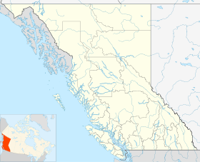
Bamberton est une communauté canadienne de la Colombie-Britannique située dans la <division de recensement> et la région administrative de <région>.
Situation
Chronologie municipale
Histoire
Toponyme
Économie
Municipalités limitrophes
 |
|
??? |
|
|
| ??? |
N |
??? |
| O ??? E |
| S |
|
??? |
|
Voir aussi
Liens externes
Wikimedia Foundation.
2010.
Contenu soumis à la licence CC-BY-SA. Source : Article Bamberton de Wikipédia en français (auteurs)
Regardez d'autres dictionnaires:
Bamberton — may refer to: * Bamberton, British Columbia * Bamberton Provincial Park … Wikipedia
Bamberton, British Columbia — Bamberton is located on the Saanich Inlet, just south of Mill Bay, 45 kilometers north of Victoria on Vancouver Island. Bamberton is named for H.K.G. Bamber, a cement manufacturer from Gravesend, England, who was original owner of DL 127 Malahat… … Wikipedia
Bamberton (Colombie-Britannique) — Bamberton Bamberton Ajouter une image Administration Pays Canada … Wikipédia en Français
Bamberton Provincial Park — is a provincial park in British Columbia, Canada. The park area consists of a beach that borders on Saanich Inlet, and is connected to a camping area by several trails. It shares its name with the now abandoned settlement of Bamberton.External… … Wikipedia
Malahat, British Columbia — Malahat or The Malahat refers to a First Nations people and the unincorporated locality, highway, and passenger train named after them on southern Vancouver Island. The Malahat , meaning primarily the highway but also the locality, is located on… … Wikipedia
Esquimalt and Nanaimo Railway — Die Esquimalt and Nanaimo Railway (seit 2006 nach zehn Jahren und mehreren Namensänderungen E N Railway oder einfach E N genannt) ist eine 160 km lange Eisenbahnverbindung auf Vancouver Island, der bei weitem größten der der kanadischen… … Deutsch Wikipedia
Duany, Andres, and Plater-Zyberk, Elizabeth — ▪ 1998 In 1980 a Florida developer hired Andres Duany and Elizabeth Plater Zyberk to design a resort called Seaside on 30 ha (80 ac) of Gulf Coast scrubland. By 1997 the Miami based husband and wife team of architects and planners were… … Universalium
Victoria, British Columbia — For other uses, see Victoria (geographical disambiguation). This article is about the city of Victoria. For electoral districts with the name Victoria, or in the area of Greater Victoria, see Victoria (electoral districts). City of Victoria… … Wikipedia
List of communities in British Columbia — This is a list of communities in British Columbia, a province in Canada. For the purposes of this list, a community is defined as either an incorporated municipality (including Indian reserves), or an unincorporated settlement inside or outside… … Wikipedia
Nanaimo — For other uses, see Nanaimo (disambiguation). City of Nanaimo Nanaimo … Wikipedia
 Canada
 Colombie-Britannique