Zeijen
Contenu soumis à la licence CC-BY-SA. Source : Article Zeijen de Wikipédia en français (auteurs)
Regardez d'autres dictionnaires:
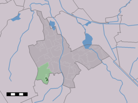
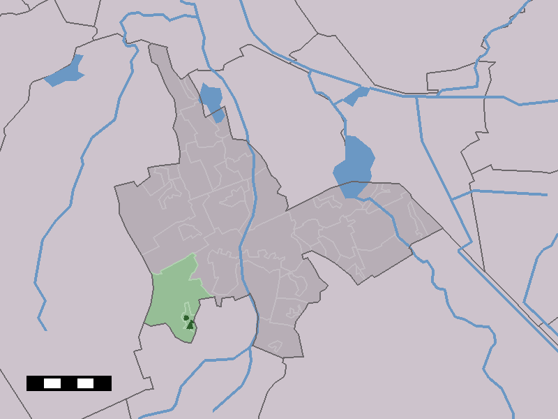
Zeijen — Dutch town locator maps mun town caption = The village centre (dark green) and the statistical district (light green) of Zeijen in the municipality of Tynaarlo.Zeijen is a village in the Dutch province of Drenthe. It is a part of the municipality … Wikipedia
Jos Hooiveld — Football player infobox playername= Jos Hooiveld fullname = nickname = Jos the Boss dateofbirth = birth date and age|1983|4|22 cityofbirth = Zeijen, village in Drenthe countryofbirth = Netherlands height = 191 cm currentclub = FC Inter Turku… … Wikipedia
Tynaarlo — Gemeinde Tynaarlo Flagge Wappen Provinz … Deutsch Wikipedia
Tynaarlo (commune) — Pour les articles homonymes, voir Tynaarlo. Tynaarlo … Wikipédia en Français
Jos Hooiveld — Nacimiento 22 de abril de 1983 Zeijen, Países Bajos Nacionalidad … Wikipedia Español
Jos Hooiveld — Jos Hooiveld Spielerinformationen Geburtstag 22. April 1983 Geburtsort Zeijen, Niederlande Position Abwehr Vereine in der Jugend … Deutsch Wikipedia
Assen — Infobox Settlement official name = Assen image size = 250px image caption = Assen railway station mapsize = 280px subdivision type = Country subdivision name = Netherlands subdivision type1 = Province subdivision name1 = Drenthe area footnotes =… … Wikipedia
Tynaarlo — Infobox Settlement official name = Tynaarlo mapsize = 280px subdivision type = Country subdivision name = Netherlands subdivision type1 = Province subdivision name1 = Drenthe area footnotes = (2006) area total km2 = 147.65 area land km2 = 143.73… … Wikipedia
Kinderdijk — Coordinates: 51°53′N 4°38′E / 51.883°N 4.633°E / 51.883; 4.633 … Wikipedia
List of places in the Netherlands — This is an alphabetical list of places (cities, towns, villages) in the Netherlands. Lists per province can be found at:* List of towns in Groningen * List of towns in Friesland * List of towns in Drente * List of towns in Overijssel * List of… … Wikipedia
 Pays-Bas