Yelizovo
- Yelizovo
-
Ielizovo
Modèle:Infobox Ville de Russie/Blason manquant
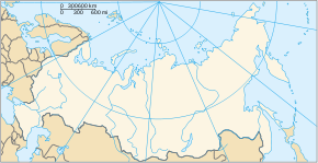
Ielizovo (en russe : Елизово) est une ville du kraï du Kamtchatka, en Russie, et le centre administratif du raïon d'Elizovski. Elle est située sur la rivière Avatcha, à 25 km au sud-ouest de Petropavlovsk-Kamtchatski. Sa population s'élevait à 39 585 habitants en 2008.
Histoire
L'origine de Ielizovo remonte à 1848, année de la fondation du village de Stary Ostrog (Ста́рый Остро́г). Il fut rebaptisé Zavoïko (Заво́йко) en 1897, en hommage à l'amiral russe Vassili Zavoïko, qui dirigea la défense de Petropavlovsk en 1854, durant la guerre de Crimée. Le village fut renommé Ielizovo en 1923. En 1964, Ielizovo obtint le statut de commune urbaine et en 1975 le statut de ville.
Population
Au cours des années 1990 la situation démographique de Ielizovo s'est dégradée. En 2001, le solde naturel accusait un déficit de 6,9 pour mille (taux de natalité 13,9 pour mille et taux de mortalité 20,8 pour mille).
Évolution démographique
| 1959 |
1970 |
1979 |
1989 |
1992 |
2002 |
2008 |
| 4 500 |
14 500 |
36 200 |
46 929 |
49 000 |
41 533 |
39 585 |
Économie
C'est à Ielizovo que se trouve l'aéroport de Petropavlovsk-Kamchatski, le plus grand aéroport du Kamtchatka.
Lien externe
Source
 Portail de la Russie
Catégorie : Ville du krai du Kamtchatka
Wikimedia Foundation.
2010.
Contenu soumis à la licence CC-BY-SA. Source : Article Yelizovo de Wikipédia en français (auteurs)
Regardez d'autres dictionnaires:
Yelizovo — ( ru. Елизово) is a town in Kamchatka Krai, Russia, located on the Avacha River 32 km north west of Petropavlovsk Kamchatsky. Population: 41,533 (2002 Census); 46,929 (1989 Census).Founded in 1848 as the village ( selo ) of Stary Ostrog ( ru.… … Wikipedia
Yelizovo — Original name in latin Yelizovo Name in other language ELIZOVO, Elizovo, Jelizovo, Yelizovo, ЕЛИЗОВО, Елизово State code RU Continent/City Asia/Kamchatka longitude 53.18909 latitude 158.38135 altitude 25 Population 40692 Date 2013 04 03 … Cities with a population over 1000 database
Yelizovo — Sp Jalizava Ap Ялізава/Yalizava baltarusiškai (gudiškai) Ap Елизово/Yelizovo rusiškai L C Baltarusija … Pasaulio vietovardžiai. Internetinė duomenų bazė
Russian Naval Aviation — Infobox Military Unit unit name = Авиация Военно морского флота Aviatsiya Voenno morskogo Flota Russian Naval Aviation caption = dates = since 1912 country = Russian Federation (previously the Soviet Union and Russian Empire) branch = Russian… … Wikipedia
Aviación Naval de Rusia — Saltar a navegación, búsqueda Un Sujoi Su 33 del 279º Regimiento de Aviación de Caza Embarcada, sobre el Portaaviones Almirante Kuznetsov La Aviación Naval de Rusia (en ruso: Авиация Военно морского флота Aviatsiya Voenno morskogo Flota), es la… … Wikipedia Español
Petropavlovsk-Kamchatsky Airport — Infobox Airport name = Yelizovo Airport nativename = nativename a = Аэропорт Елизово nativename r = image width = caption = IATA = PKC ICAO = UHPP type = Public owner = operator = Petropavlovsk Kamchatsky Air Enterprise city served = location =… … Wikipedia
Sputnik 1 — Infobox Spacecraft Name = Sputnik 1 Спутник 1 Organization = Council of Ministers of the USSR Major Contractors = OKB 1, Soviet Ministry of Radiotechnical Industry Mission Type = Atmospheric studies Satellite Of = Earth Launch = October 4, 1957,… … Wikipedia
List of cities and towns in Russia — This is a list of cities and towns in Russia. According to the data of 2002 Russian Census, there are 1,108 cities and towns in Russia. City Russian name Federal subject Abakan Абакан Republic of Khakassia Abaza Абаза Republic of Khakassia… … Wikipedia
Kamchatka Peninsula — The Kamchatka Peninsula ( ru. полуостров Камчатка) is a 1,250 kilometer long peninsula in the Russian Far East, with an area of 472,300 km². It lies between the Pacific Ocean to the east and the Sea of Okhotsk to the west. [cite web author= year … Wikipedia
List of renamed cities and towns in Russia — Reasons for geographical renaming in Russia were *an especially large number of cities and towns were renamed in Russia after the October Revolution of 1917 *more renamings happened during the whole history of the Soviet Union due to political… … Wikipedia
 Russie
 Kraï du Kamtchatka
 39 585 hab. (2008)


