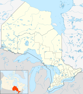
Waubaushene
Contenu soumis à la licence CC-BY-SA. Source : Article Waubaushene de Wikipédia en français (auteurs)
Regardez d'autres dictionnaires:
Ty Arbour — Ernest Arbour Données clés Né le 29 juin 1896, Waubaushene (Canada) Mort le 11 février 1979 Joueur décédé Position Ailier gauche Tirait de la gauche … Wikipédia en Français
Ontario Highway 12 — Highway 12 Route information Length: 145.1 … Wikipedia
List of NHL players (A) — This is a list of National Hockey League (NHL) players who have played at least one game in the NHL from 1917 to present and have a last name that starts with A . Contents 1 Aalto Allen 2 Alley Apps 3 Arbour Ayres 4 … Wikipedia
Ontario Highway 103 — Highway 103 Route information Maintained by the Ministry of Transportation of Ontario Length: 46.3 km[1] (28.8 mi) Existed … Wikipedia
Martyrs' Shrine — For other uses, see Martyrs Shrine (disambiguation). Martyr s Shrine church Midland, Ontario Denomination Roman Catholic Website http://www.martyrs shrine.com/ Mar … Wikipedia
Highway 12 (Ontario) — Infobox road province=ON type=Hwy route=12 alternate name= length km= length ref=Ministry of Transportation of Ontario, [http://www.raqsa.mto.gov.on.ca/techpubs/TrafficVolumes.nsf/tvweb 2004 Annual Average Daily Traffic] ] length round=1… … Wikipedia
Jack Arbour — Infobox Ice Hockey Player position = Defence shot = Left height ft = 5 height in = 8 weight lb = 172 played for = WCHL Calgary Tigers NHL Detroit Cougars Toronto Maple Leafs IHL Windsor Bulldogs PCHL Spokane Clippers nationality = CAN birth date … Wikipedia
Jack Arbour — Kanada Jack Arbour Personenbezogene Informationen Geburtsdatum 7. März 1898 Geburtsort Waubaushene, Ontario, Kanada … Deutsch Wikipedia
Amos Arbour — Données clés Surnom Butch Nationalité Canada Né le 18 janvier 1895, Waubaushene (Canada) Mort … Wikipédia en Français
Ontario Highway 169 — Highway 169 Route information Length: 91.6 km[2] (56.9 mi) Existed … Wikipedia
 Canada
 Ontario


