Warwick (Rhode Island)
- Warwick (Rhode Island)
-
 Pour les articles homonymes
,
voir Warwick.
41° 43′ 05″ N 71° 24′ 55″ W / 41.718056, -71.415278
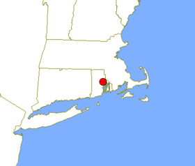
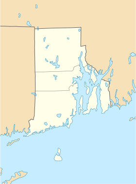
Warwick est une ville américaine située dans le comté de Kent, État du Rhode Island. En 2005, sa population s’élevait à 87 233 habitants, ce qui en fait la plus grande ville du comté (les comtés du Rhode Island n’ont pas de siège). Densité : 403,3 hab/km² (1 044,7 hab/mi²). Superficie totale : 128,5 km² (49,6 mi²), dont 91,9 km² (35,5 mi²) sont de terre.
Histoire
Warwick a été fondée en 1642 par Samuel Gorton, fondateur des Gortonites. Il a acheté aux Amérindiens Narragansett une portion de terre. L’endroit s’appelait alors Shawomet.
La ville a été incorporée en 1931. Elle est la plus peuplée du comté.
Source
Wikimedia Foundation.
2010.
Contenu soumis à la licence CC-BY-SA. Source : Article Warwick (Rhode Island) de Wikipédia en français (auteurs)
Regardez d'autres dictionnaires:
Warwick (Rhode Island) — Warwick … Wikipedia Español
Warwick (Rhode Island) — Warwick … Deutsch Wikipedia
Warwick, Rhode Island — Infobox Settlement official name = City of Warwick settlement type = City imagesize = image caption = Warwick City Hall established title2 = Incorporated (city) established date2 = 1931 established title = Incorporated (town) established date =… … Wikipedia
West Warwick, Rhode Island — Infobox Settlement official name = West Warwick, Rhode Island settlement type = Town nickname = motto = imagesize = image caption = War Memorial Park West Warwick image mapsize = 250px map caption = Location of West Warwick in Rhode Island… … Wikipedia
Warwick Neck, Rhode Island — Warwick Neck is a part of the City of Warwick, Rhode Island, United States. This section of city was first settled in 1660s and played a prominent part of the early history of Rhode Island including colonist skirmishes with the native American… … Wikipedia
Rhode Island Route 4 — Route 4 Colonel Rodman Highway … Wikipedia
Rhode Island Route 3 — For the Route 3 that existed in the 1920s, see U.S. Route 6 in Rhode Island. RI 3 redirects here. RI 3 may also refer to Rhode Island s 3rd congressional district. Route 3 … Wikipedia
Rhode Island Mall — Infobox shopping mall shopping mall name = Rhode Island Mall image width = caption = location = Warwick, Rhode Island, USA address = coordinates = opening date = 1968 developer = manager = owner = architect = number of stores = approx. 10 number… … Wikipedia
Rhode Island Republican Party — Infobox American State Political Party party name = Rhode Island Republican Party party articletitle = Republican Party (United States) party website = [http://www.rigop.org www.rigop.org] headquarters = 1800 Post Rd., Suite 17 I Warwick, Rhode… … Wikipedia
Rhode Island — Rhode Islander. /rohd/ a state of the NE United States, on the Atlantic coast: a part of New England. 947,154; 1214 sq. mi. (3145 sq. km). Cap.: Providence. Abbr.: RI (for use with zip code), R.I. * * * officially Rhode Island and Providence… … Universalium
 États-Unis
 Rhode Island


