Waarland
Contenu soumis à la licence CC-BY-SA. Source : Article Waarland de Wikipédia en français (auteurs)
Regardez d'autres dictionnaires:
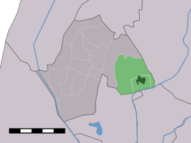
Waarland — Dutch town locator maps mun town caption = The town centre (dark green) and the statistical district (light green) of Waarland in the municipality of Harenkarspel.Waarland (West Frisian: ´t Waarland ) (coord|52|44|N|4|50|E|type:city(1423)) is a… … Wikipedia
List of windmills in Noord Holland — A list of windmills in the Dutch province of Noord Holland.{| class= wikitable ! Location! Name of mill! Type! Built! Notes! Photograph Aalsmeer De Leeuw Stellingmolen 1863 [http://www.molendatabase.nl/nederland/molen.php?nummer=621… … Wikipedia
Harenkarspel — Gemeinde Harenkarspel Flagge Wappen Provinz Nordholland Bü … Deutsch Wikipedia
Harenkarspel — Infobox Settlement official name = Harenkarspel mapsize = 280px flag size = 150x75px image shield = Harenkarspel wapen.png shield size = 150x75px subdivision type = Country subdivision name = Netherlands subdivision type1 = Province subdivision… … Wikipedia
Kinderdijk — Coordinates: 51°53′N 4°38′E / 51.883°N 4.633°E / 51.883; 4.633 … Wikipedia
List of places in the Netherlands — This is an alphabetical list of places (cities, towns, villages) in the Netherlands. Lists per province can be found at:* List of towns in Groningen * List of towns in Friesland * List of towns in Drente * List of towns in Overijssel * List of… … Wikipedia
De Adriaan, Haarlem — Windmill De Adriaan De Adriaan is a windmill in the Netherlands that burnt down in 1932 and was rebuilt in 2002. The original windmill dates from 1779 and the mill has been a distinctive part of the skyline of Haarlem for centuries. Contents … Wikipedia
Sander Berk — Sander Johannes Gerardes Berk (born July 10, 1979 in Nieuwveen) is a Dutch triathlete. [http://results.beijing2008.cn/WRM/ENG/BIO/Athlete/8/217918.shtml Athlete biography: Sander Berk] , beijing2008.cn, ret: Aug 13, 2008] Berk won his first run… … Wikipedia
't Rijpje — 52°45′7″N 4°44′51″E / 52.75194, 4.7475 … Wikipédia en Français
Dirkshorn — 52° 45′ 00″ N 4° 47′ 00″ E / 52.75, 4.78333 … Wikipédia en Français
 Pays-Bas