Vranpotok

Vranpotok

43° 39′ 34″ N 18° 59′ 53″ E / 43.6594, 18.9981

Vranpotok
Administration
Pays Drapeau de Bosnie-Herzégovine Bosnie-Herzégovine
Entité Drapeau de la Fédération de Bosnie-et-Herzégovine Fédération de Bosnie-et-Herzégovine
Canton Podrinje bosnien
Municipalité Goražde
Géographie
Coordonnées 43° 39′ 34″ Nord
       18° 59′ 53″ Est
/ 43.6594, 18.9981
Démographie
Population 93 hab. (1991)
Localisation
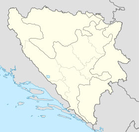
Bosnia and Herzegovina location map.svg
City locator 14.svg
Vranpotok

Vranpotok (en cyrillique : Вранпоток) est un village de Bosnie-Herzégovine. Il est situé dans la municipalité de Goražde et dans le canton du Podrinje bosnien, Fédération de Bosnie-et-Herzégovine. Au recensement de 1991, il comptait 93 habitants, dont une majorité de Musulmans (Bosniaques)[1].

Sommaire

Démographie

Répartition de la population (1991)

Nationalité Nombre %
Musulmans 91 97,85
Yougoslaves 2 2,15[1]

Notes et références

  1. a et b (bs)(hr)(sr) Livre : Composition nationale de la population - Résultats de la République par municipalités et localités 1991, Bulletin statistique n°234, Publication de l'Institut national de statistique de Bosnie-Herzégovine, Sarajevo.

Voir aussi

Articles connexes

Liens externes


Wikimedia Foundation. 2010.

Contenu soumis à la licence CC-BY-SA. Source : Article Vranpotok de Wikipédia en français (auteurs)

Игры ⚽ Нужно решить контрольную?

Regardez d'autres dictionnaires:

  • Gorazde (Bosnie-Herzegovine) — Goražde (Bosnie Herzégovine) Pour les articles homonymes, voir Goražde. Goražde Горажде [[Image:|100px|center|Blason]] [[Image:|100px|center|Drapeau]] …   Wikipédia en Français

  • Goražde (Bosnie-Herzégovine) — Pour les articles homonymes, voir Goražde. 43° 40′ 01″ N 18° 58′ 35″ E …   Wikipédia en Français

  • List of settlements in Bosnia and Herzegovina — This is a complete list of settlements in Bosnia and Herzegovina, as recorded by 1991 census, sorted by municipalities. Town of Sarajevo = Sarajevo Centar = • Mrkovići • Nahorevo• Poljine• Radava• Sarajevo (part of settlement)• Vića Sarajevo… …   Wikipedia

  • List of settlements in the Federation of Bosnia and Herzegovina/V — Va Vašarovići Ve Vedro Polje, Velika Kladuša, Veliki Ograđenik, Veluša, Velja Međa (municipality Ravno), Veljaci, Vesela Vi Vihovići (municipality Mostar), Vileši, Vinište, Vinjani, Vionica, Vir, Visoko, Vitez, Vitina, Vitkovići, Višići Vl Vinine …   Wikipedia

  • Ahmovici — Ahmovići Ahmovići Ахмовићи [[Image:|100px|center|Blason]] [[Image:|100px|center|Drapeau]] Blason Drapeau …   Wikipédia en Français

  • Ahmovići — 43° 37′ 31″ N 18° 56′ 32″ E / 43.6253, 18.9422 …   Wikipédia en Français

  • Bacci — Bačci Bačci Бачци [[Image:|100px|center|Blason]] [[Image:|100px|center|Drapeau]] Blason Drapeau …   Wikipédia en Français

  • Bahovo — 43° 38′ 27″ N 18° 46′ 35″ E / 43.6408, 18.7764 …   Wikipédia en Français

  • Bakije — 43° 37′ 51″ N 18° 52′ 43″ E / 43.6308, 18.8786 …   Wikipédia en Français

  • Bare (Goražde) — Pour les articles homonymes, voir Bare. 43° 38′ 35″ N 18° 55′ 26″ E …   Wikipédia en Français

Share the article and excerpts

Direct link
Do a right-click on the link above
and select “Copy Link”