Vallila
- Vallila
-
60° 11′ 40″ N 24° 57′ 24″ E / 60.19445, 24.95667

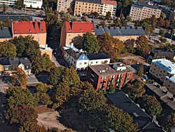
Vue aérienne de Vallila,
la rue Hämeentie en arrière plan.
Vallila(fi)
Vallgård (sv)
Vallila(fi)
Vallgård (sv)
Données clés
| No du district |
303 |
| Superdistrict |
Centre |
| Superficie |
2,36 km2 |
| Population |
10 822 hab. (2004) |
| Densité |
4 585,59 hab./km2 |
| Subdivisions |
Hermanni, Vallila |
Vallila (suédois : Vallgård) est un quartier d'Helsinki, la capitale finlandaise, c'est aussi le nom d'un district de Vallila qui comprend le quartier éponyme.

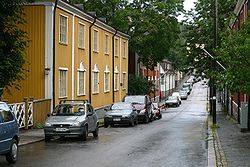
Maisons en bois de Puu-Vallila.
Description
Le quartier de Vallila
Le quartier de Vallila (en finnois : Vallila kaupunginosa) a 7242 habitants (1.1.2008) [1] sur une superficie de 1,30 km2[1]. A la fin 2005, le quartier offre 17176 emplois[1].
Le district de Vallila
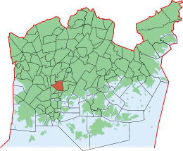
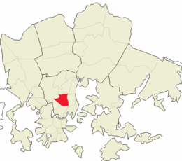
Le district de Vallila se compose des quartiers de Hermanni et de Vallila. Le district de Vallila (en finnois : Vallilan peruspiiri) a 10822 habitants[1] et 20807 emplois[1] pour une superficie de 2,36 km2[1].
Liens externes
Sur les autres projets Wikimedia :
Références
Galerie
-
-
-
Cours de maisons à Puu-Vallila.
-
Croisement de la rue Vallilantie et de la rue Suvannontie.
-
Vue aérienne de Vallila, la rue Hämeentie en arrière plan.
-
Cours d'immeubles de la rue Somerontie.
-
-
-
Eglise Saint Paul d’Helsinki
-
Catégories : - Quartier d'Helsinki
- District d'Helsinki
Wikimedia Foundation.
2010.
Contenu soumis à la licence CC-BY-SA. Source : Article Vallila de Wikipédia en français (auteurs)
Regardez d'autres dictionnaires:
Vallila — (Vallgård) Stadtteil Nr. 22 von Helsinki … Deutsch Wikipedia
Vallila — Subdivisions of Helsinki subdivision name = Vallila subdivision name swe = Vallgård subdivision number = 22 district = Central area = 1.30 population = 7,393 (01/01/2004) density = 5,687 postcode = 00510, 00550 neighbours = Sörnäinen, Alppiharju … Wikipedia
Vallgård — Vallila 60° 11′ 40″ N 24° 57′ 24″ E / 60.19445, 24.95667 … Wikipédia en Français
Valkka — Vallila Valkka on kyl viel Stadii … Suomen slangisanakirjaa
Vallgård — Vallila Vallgård Stadtteil Nr. 22 von Helsinki … Deutsch Wikipedia
Helsinki tram — Infobox Public transit name = Helsinki tram imagesize = locale = Helsinki, Finland transit type = Tramway began operation = 1891 ended operation = system length =Totalconvert|110|km|mi|1|abbr=onPassenger trafficconvert|89.5|km|mi|1|abbr=on lines … Wikipedia
Hermanni — 60°12′N 24°59′E / 60.2, 24.983 … Wikipédia en Français
Subdivisions d'Helsinki — La ville d Helsinki, capitale de la Finlande, est découpée en subdivisions de tailles et de natures variées. Le découpage fait intervenir des quartiers, des districts, des superdistricts, des sections et des secteurs. Sa complexité le rend… … Wikipédia en Français
Subdivisions of Helsinki — The city of Helsinki, the capital of Finland, can be divided into various different sorts of subdivisions. The subdivisions include neighbourhoods, districts, major districts and postal code areas. The plethora of different official ways to… … Wikipedia
Kumpula — Subdivisions of Helsinki subdivision name = Kumpula subdivision name swe = Gumtäkt subdivision number = 24 district = Central area = 1.53 population = 3,589 (1/1/04) density = 2,346 postcode = 00550, 00560 neighbours = Pasila, Hermanni, Vallila,… … Wikipedia


