Ulicoten
Contenu soumis à la licence CC-BY-SA. Source : Article Ulicoten de Wikipédia en français (auteurs)
Regardez d'autres dictionnaires:
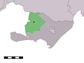
Ulicoten — Dutch town locator maps mun town caption = The town centre (dark green) and the statistical district (light green) of Ulicoten in the municipality of Baarle Nassau.Ulicoten (coord|51|27|N|4|51|E|type:city(373)) is a town in the Dutch province of… … Wikipedia
Holiday home Isidorus Hoeve Ulicoten — (Ulicoten,Нидерланды) Категория отеля: 2 звездочный отель Адрес … Каталог отелей
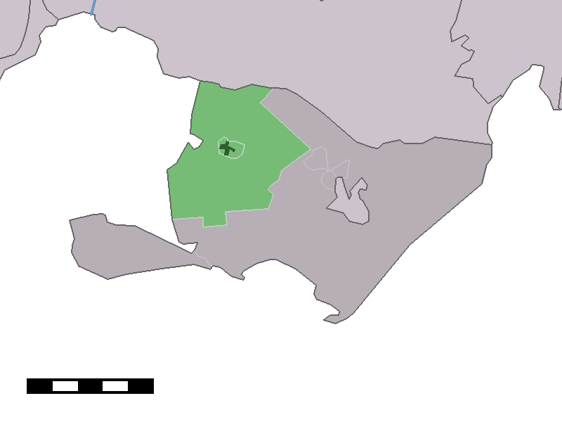
Heikant (Ulicoten) — Dutch town locator maps mun town caption = Heikant in the municipality of Baarle Nassau.Heikant is a hamlet in the Dutch province of North Brabant. It is a part of the municipality of Baarle Nassau, and lies about 16 km south of Breda, just south … Wikipedia
Heikant — is the name of several villages in the south of the Netherlands and in Belgium. Contents 1 Netherlands 1.1 Province of Gelderland 1.2 Province of Zeeland 1.3 … Wikipedia
Baarle-Nassau — Héraldique … Wikipédia en Français
Baerle-Duc — (nl) Baarle Hertog Géolocalisation sur la carte : Belgique … Wikipédia en Français
Baarle-Nassau — Infobox Settlement official name = Baarle Nassau mapsize = 280px subdivision type = Country subdivision name = Netherlands subdivision type1 = Province subdivision name1 = North Brabant area footnotes = (2006) area total km2 = 76.30 area land km2 … Wikipedia
List of places in the Netherlands — This is an alphabetical list of places (cities, towns, villages) in the Netherlands. Lists per province can be found at:* List of towns in Groningen * List of towns in Friesland * List of towns in Drente * List of towns in Overijssel * List of… … Wikipedia
Boshoven (Brabant-Septentrional) — Pour les articles homonymes, voir Boshoven. Boshoven Administration Pays … Wikipédia en Français
Castelré — 51°25′31″N 4°46′47″E / 51.42528, 4.77972 … Wikipédia en Français
 Pays-Bas