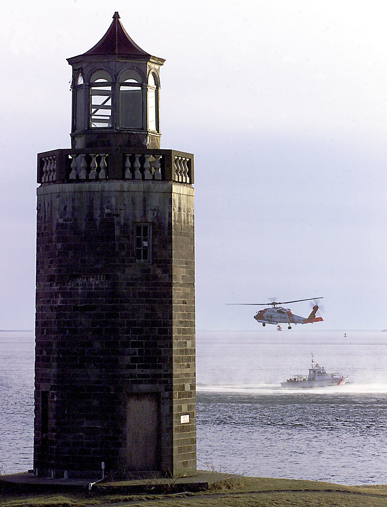
Avery Point Light
- Avery Point Light
-
Avery Point Light
Avery Point Lighthouse est un phare à Groton, dans le Connecticut, aux États-Unis, situé sur le campus Avery Point de l'Université du Connecticut. C'est le dernier phare construit dans cet État.
Histoire
Avery Point Lighthouse, construit comme mémorial à tous les autres phares et gardiens de phare, fut terminé en 1943, pendant la Seconde Guerre mondiale, et ne fut pas éclairé directement dû à la possibilité d'invasions ennemies par la mer. Il entra finalement en service en 1944. Le phare fut désactivé je 25 juin 1967, quand la US Coast Guard déplaça ses installations d'entraînement d'Avery Point à Governors Island. Le phare fut abandonné jusqu'en 1999, sa restauration commença en 2004 et dura deux ans, jusqu'en 2006. Il fut rallumé et répertorié comme aide officielle à la navigation le 15 octobre 2006.
|
Liste des phares du Connecticut |
| Avery Point Light • Black Rock Harbor Light • Bridgeport Harbor Light • Falkner Island Light • Five Mile Point • Great Captain Island Light • Greens Ledge Light • Lynde Point Light • Morgan Point Light • Mystic Seaport Light • New London Harbor Light • New London Ledge Light • Pecks Ledge Light • Penfield Reef Light • Saybrook Breakwater Light • Southwest Ledge Light • Stamford Harbor Ledge Light • Stonington Harbor Light • Stratford Point Light • Stratford Shoal Light • Tongue Point Light |
 |
Catégories : Connecticut | Phare des États-Unis
Wikimedia Foundation.
2010.
Contenu soumis à la licence CC-BY-SA. Source : Article Avery Point Light de Wikipédia en français (auteurs)
Regardez d'autres dictionnaires:
Avery Point Light — Infobox Lighthouse caption = location = Groton, Connecticut coordinates = coord|41.31515|N|72.0635|W|region:US type:landmark|name=Avery Point Lighthouse|display=inline,title yearbuilt = 1943 yearlit = 1944 automated = yeardeactivated = 1967 2006… … Wikipedia
Morgan Point Light — Location Noank, Connecticut Year first constructed 1868 Year first lit 1868 Deactivated 1919 Foundation Natural Granite Construction Wood … Wikipedia
Phare d'Avery Point — Le phare d Avery Point Light en 2000, avant sa rénovation Coordonnées … Wikipédia en Français
Mission Point Light — Location Peninsula Township, Michigan Coordinates … Wikipedia
Crown Point Light — pre 1926 photograph of present Crown Point Light, showing attached keeper s house (USCG) Location on Crown Point on Lake Champlain Coordinates … Wikipedia
Sturgeon Point Light — Infobox Lighthouse caption = The light in winter. location = Alcona County, Michigan coordinates = coord|44|42|45.7|N|83|16|21.8|W yearbuilt = 1869 yearlit = 1869 automated = 1939 yeardeactivated = foundation = Limestone construction = Brick… … Wikipedia
Grosse Point Light — Infobox Lighthouse caption = Grosse Point Light Station location = Evanston, Illinois coordinates = coord|42|3|50|N|87|40|33.7|W|region:US type:landmark yearbuilt = 1873 yearlit = 1874 automated = 1935cite… … Wikipedia
Doubling Point Light — The keeper s house is under the trees Location Kennebec River , Maine Year first constructed 1898 Automated 1988 Tower shape Octagonal Wood Tower Markings / pattern White … Wikipedia
Whitefish Point Light — Infobox Lighthouse caption = Vintage image of Whitefish Point Light station location = Whitefish Bay coordinates = coord|46|46|14|N|84|57|24|W|region:US type:landmark|display=inline,title yearlit = 1861 automated = 1971 yeardeactivated = N/A… … Wikipedia
Peninsula Point Light — Infobox Lighthouse caption = Peninsula Point Lighthouse location = Stonington, Michigan coordinates = coord|45.6682| 86.9666| yearlit = 1866 automated = 1922 yeardeactivated = 1936 [ [http://www.michiganlights.com/peninsulapointlh.htm Michigan… … Wikipedia
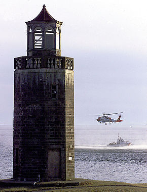 Le phare d'Avery Point Light en 2000, avant sa rénovation