- Sveta Gera
-
Sveta Gera 
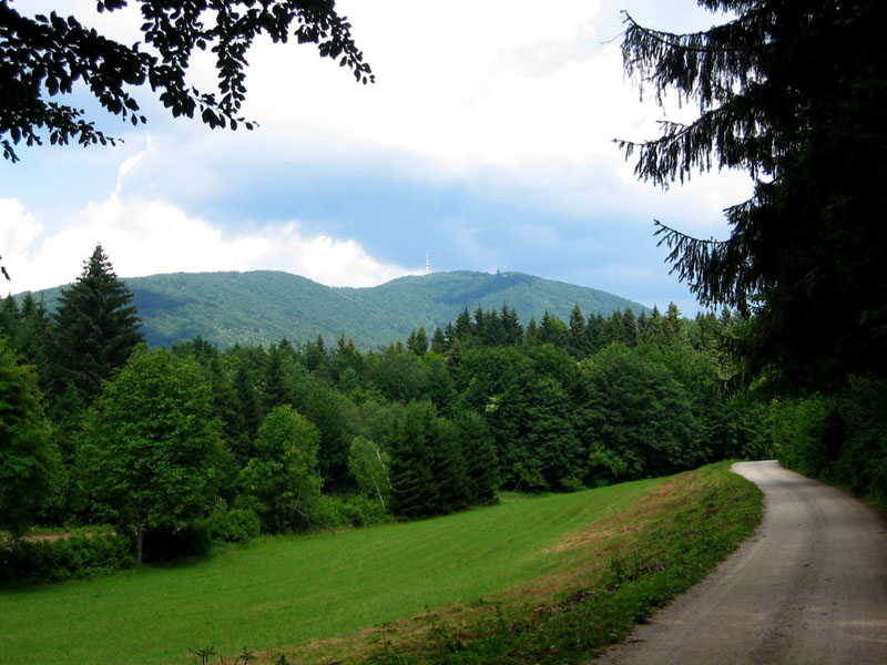
Vue du sommet du Sveta Gera depuis la Slovénie.Géographie Altitude 1 181 m Massif Žumberak (Alpes dinariques) Coordonnées Administration Pays  Croatie
Comitat Karlovac Municipalité Ozalj Géolocalisation sur la carte : Croatie

modifier 
La Sveta Gera (slovène : Trdinov vrh, allemand : St. Geraberg, Gorianc, Sichelberg[1]) est le point culminant du massif montagneux du Žumberak. Son sommet est situé en Croatie à proximité de la frontière avec la Slovénie[2] et il culmine à 1 181 metres[3]. En Slovénie, la montagne était également nommée Sveta Jera mais la montagne fut rebaptisée en 1923 d'après l'écrivain slovène Janez Trdina.
Notes et références
- (de) Karst [2] Meyers Großes Konversations-Lexikon, Band 10., Leipzig, 1907., p. 680-681. « ... und in dem gegen das rechte Saveufer streichenden Uskokengebirge mit dem St. Geraberg (Gorianc) 1181 m erreichend. »
- (en)Une carte topographique de Sveta Gera sur summitpost.com
- (fr)La Croatie - Façade méditerranéenne de l'Europe centrale
Catégories :- Sommet de Croatie
- Sommet des Alpes dinariques

Wikimedia Foundation. 2010.