South Havra
- South Havra
-
South Havra est une île des Shetland.
Catégories :
- Île des Shetland
- Île de la mer de Norvège
Wikimedia Foundation.
2010.
Contenu soumis à la licence CC-BY-SA. Source : Article South Havra de Wikipédia en français (auteurs)
Regardez d'autres dictionnaires:
South Havra — es una de las islas Scalloway, pertenecientes al archipiélago de las islas Shetland, en Escocia. La isla permanece deshabitada desde 1923. Se encuentra ubicada al sur de Burra y al oeste de la península meridional de la isla Mainland. Las… … Wikipedia Español
South Havra — Infobox Scottish island | latitude= 60.03 longitude= 1.35 GridReference=HU360268 celtic name= norse name= Hafrey meaning of name= ewe island area=59 ha area rank= 180= highest elevation= 42 m Population=0 population rank= main settlement= island… … Wikipedia
South — Contenido 1 Lugares 1.1 Europa 1.2 América 2 Transporte … Wikipedia Español
Havrå — NOTOC Havrå or Havre sometimes Havretunet or Havråtunet is a country line courtyard in Osterøy municipality in Hordaland, Norway, and is one of the very last and best preserved of the common country courtyards at the Western coast of Norway.… … Wikipedia
North Havra — (Old Norse: Hafrey, ocean island) is a small island off south west Shetland. It is 30 metres at its highest point. Situated 1/3 mile from the ness end of South Whiteness, the island possess a lighthouse and a couple of small sheep pens (crubs),… … Wikipedia
Little Havra — is a small island off the west of South Mainland in Shetland. It is 35m at its highest point, on which there is a cairn.It is to the west of South Havra.References* [http://shetlopedia.com/Little Havra Shetlopedia] … Wikipedia
Список Шетландских островов — Шетландский архипелаг … Википедия
List of Shetland islands — This is a list of Shetland islands in Scotland. The Shetland archipelago is located 100 kilometres (62 miles) north of mainland Scotland and the capital Lerwick is almost equidistant from Bergen in Norway and Aberdeen in Scotland. The Shetland… … Wikipedia
Liste britischer Inseln — Lage der Britischen Inseln Diese Liste führt die wichtigsten der etwa 600 Inseln der Britischen Inseln auf. Politisch sind diese Inseln Teil des Vereinigten Königreiches, der Republik Irland und der Isle of Man, die als Kronbesitz kein… … Deutsch Wikipedia
Liste der Britischen Inseln — Lage der Britischen Inseln Diese Liste führt die wichtigsten der etwa 600 Inseln der Britischen Inseln auf. Politisch sind diese Inseln Teil des Vereinigten Königreichs, der Republik Irland und der Isle of Man, die als Kronbesitz kein Bestandteil … Deutsch Wikipedia
 Royaume-Uni
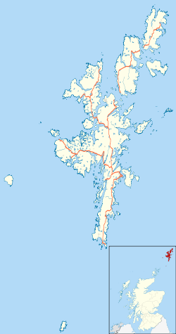
 South Havra

