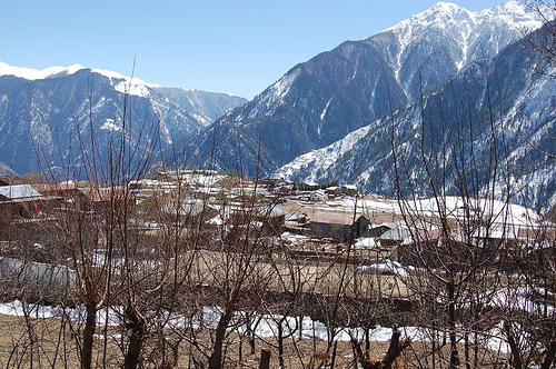
Simikot
Contenu soumis à la licence CC-BY-SA. Source : Article Simikot de Wikipédia en français (auteurs)
Regardez d'autres dictionnaires:
Simikot — Infobox Settlement official name = Simikot other name = native name = nickname = settlement type = motto = imagesize = 300px image caption = flag size = image seal size = image shield = shield size = image blank emblem = blank emblem type = blank … Wikipedia
Simikot Airport — is an airport in Simikot, Nepal airport codes|IMK|VNST.Airlines and destinations*Yeti Airlines (Nepalganj)References* [http://www.farecompare.com/flights/Simikot IMK/city.html Simikot Destinations] … Wikipedia
IMK — Simikot, Nepal (Regional » Airport Codes) ** Indiana Michigan Power Company (Business » NYSE Symbols) … Abbreviations dictionary
List of airports in Nepal — Map of Nepal This is a list of airports in Nepal, sorted by location. Nepal (Nepali: नेपाल), officially the Federal Democratic Republic of Nepal, is a landlocked country in South Asia. It is bordered to the north by the People s Republic of China … Wikipedia
Dornier Do 228 — Dornier 228 LGW Do 228 200 Role Airliner Manufacturer … Wikipedia
Humla District — Infobox Nepal district district = Humla District area = 5,655 population = 40,595 pop year = 2001 density = caption = region = established = languages = website = Humla District, a part of Karnali Zone, is one of the seventy five districts of… … Wikipedia
List of Nepal-related topics — This is a list of topics related to Nepal. Those interested in the subject can monitor changes to the pages by clicking on Related changes in the sidebar.Nepal* Nepal * Nepal, Travel information * * Nepal Bhasa * Institute of Medicine, Nepal *… … Wikipedia
Nepalgunj Airport — IATA: KEP – ICAO: VNNG … Wikipedia
Nepal Airlines destinations — Main article: Nepal Airlines Nepal Airlines offers scheduled flights to the following destinations (as of July 2011)[1][2] † Base [T] Terminated route City Country IATA ICAO Airport Notes Amsterdam … Wikipedia
RNAC — Nepal Airlines IATA Code: RA ICAO Code: RNA … Deutsch Wikipedia

 Népal
Népal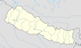
 Simikot