- Atebubu-Amatin
-
Atebubu-Amantin
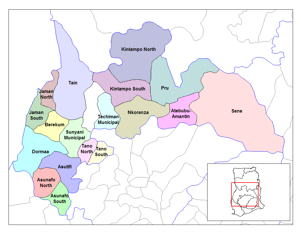
Atebubu-Amantin Pays Ghana Région Brong Ahafo Catégorie de District Ordinaire Gouverneur Cassius Osei-Poku Capitale Atebubu Superficie 4 407 km² Population (2004) 179 485 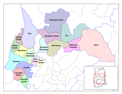 Les districts de la région de Brong Ahafo
Le district d’Atebubu-Amantin est l’un des 22 districts de la Région de Brong Ahafo.
Source
Les districts de la région de Brong Ahafo 
Asunafo nord municipalité - Asunafo sud - Asutifi - Atebubu-Amantin - Berekum municipalité - Dormaa est - Dormaa municipalité - Jaman nord - Jaman sud - Kintampo nord municipalité - Kintampo sud - Nkoranza nord - Nkoranza sud - Pru - Sene - Sunyani municipalité - Sunyani ouest - Tain - Tano nord - Tano sud - Techiman municipalité - Wenchi municipalité
 Portail de l’Afrique
Catégorie : District du Ghana
Wikimedia Foundation. 2010.