Raudfjorden
- Raudfjorden
-
Raudfjorden (« fjord rouge ») est un fjord de 20 km de long et 5 km de large sur la côte nord-ouest du Spitzberg.
Il a deux branches sud, Klinckowströmfjorden et Ayerfjorden.
Wikimedia Foundation.
2010.
Contenu soumis à la licence CC-BY-SA. Source : Article Raudfjorden de Wikipédia en français (auteurs)
Regardez d'autres dictionnaires:
Raudfjorden — (English: Red fjord) is a 20 km long and 5 km wide fjord on the northwestern coast of Spitsbergen. It has two southern branches, Klinckowströmfjorden and Ayerfjorden. The fjord is situated on the divide between Albert I Land and Haakon VII Land.… … Wikipedia
Брюс, Уильям Спирс — В Википедии есть статьи о других людях с именем Уильям Брюс. В Википедии есть статьи о других людях с такой фамилией, см. Брюс. Уильям Спирс Брюс William Speirs Bruce … Википедия
Robert Fotherby — was an early 17th century English explorer and whaler. From 1613 to 1615 he worked for the Muscovy Company, and later for the East India Company. Family TiesThere was a family of Fotherbys in Grimsby, Lincolnshire. Robert Fotherby probably… … Wikipedia
William S. Bruce — William Speirs Bruce Pour les articles homonymes, voir William Bruce et Bruce. William Speirs Bruce … Wikipédia en Français
William Speirs Bruce — Pour les articles homonymes, voir William Bruce et Bruce. William Speirs Bruce … Wikipédia en Français
Willem Barents — Retrato de Willem Barents Nacimiento … Wikipedia Español
William Speirs Bruce — en 1903. N … Wikipedia Español
Великие географические открытия — Планисфера Кантино (1502), старейшая из сохранившихся португальских навигационных карт, показывающая результаты экспедиций Васко да Гамы, Христофора Колумба и других исследователей. На ней также изображён меридиан, разде … Википедия
 Norvège
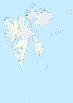


 Portail de la Norvège
 Portail du monde maritime
 Portail de l’Arctique