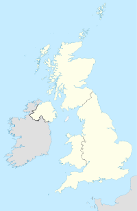
Radnage
Contenu soumis à la licence CC-BY-SA. Source : Article Radnage de Wikipédia en français (auteurs)
Regardez d'autres dictionnaires:
Radnage — infobox UK place country = England latitude= 51.6678 longitude= 0.8698 official name= Radnage population= 658 [ [http://www.neighbourhood.statistics.gov.uk/dissemination/LeadTableView.do?a=7 b=792167 c=Radnage d=16 e=15 g=425394 i=1001x1003x1004… … Wikipedia
Radnage — Recorded in several spelling forms including Radage, Radnage, Radnedge, and probably overlapping with the surnames Raddish, Reddish and Redditch, this is an English surname. It is locational from either Radnedge, a village in the county of… … Surnames reference
Horsleys Green — Coordinates: 51°39′N 0°52′W / 51.65°N 0.86°W / 51.65; 00.86 … Wikipedia
High Wycombe — This article is about the town in the United Kingdom. For the suburb of Perth, see High Wycombe, Western Australia. Coordinates: 51°37′43″N 0°44′54″W / 51.628661°N 0.748238 … Wikipedia
Owlswick — St Peters Chapel … Wikipedia
Monks Risborough — Coordinates: 51°44′04″N 0°49′47″W / 51.734462°N 0.829831°W / 51.734462; 0.829831 … Wikipedia
Princes Risborough — Coordinates: 51°43′26″N 0°50′04″W / 51.723978°N 0.834418°W / 51.723978; 0.834418 … Wikipedia
Marsh, Buckinghamshire — Coordinates: 51°46′19″N 0°49′23″W / 51.772°N 0.823°W / 51.772; 0.823 Marsh is a hamlet in the parish … Wikipedia
Bourne End, Buckinghamshire — Coordinates: 51°34′54″N 0°42′48″W / 51.581737°N 0.713382°W / 51.581737; 0.713382 … Wikipedia
Chalkshire — is a hamlet in the parish of Ellesborough, in Buckinghamshire, England. It is situated on the road that runs from Butlers Cross to Terrick. The hamlet name is fairly modern, and is quite literal in meaning. It refers to the composition of the… … Wikipedia
 Angleterre
