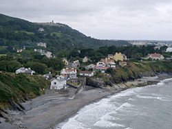
Port e Vullen
- Port e Vullen
-
54° 18′ 21″ N 4° 21′ 07″ W / 54.305833, -4.3519444
Port e Vullen (« Port du Moulin » en mannois[1]) est un bourg de l'île de Man, situé dans la paroisse de Maughold, à deux kilomètres environ à l'est de Ramsey. Il est connu principalement pour sa chapelle méthodiste, qui fut construite dans les années 1830.
Les falaises qui bordent le village sont la destination de grimpeurs. Des compétitions y sont parfois organisées.
Le chemin de fer électrique mannois y passe, Port e Vullen possédant une gare de trains.
Annexes
Notes et références
- ↑ (en) An illustrated encyclopedia of the Isle of Man, The Manx Experience, Douglas, 1997, p. 124.
Liens externes
Wikimedia Foundation.
2010.
Contenu soumis à la licence CC-BY-SA. Source : Article Port e Vullen de Wikipédia en français (auteurs)
Regardez d'autres dictionnaires:
Port-e-Vullen — 54° 18′ 21″ N 4° 21′ 07″ W / 54.305833, 4.3519444 … Wikipédia en Français
Port-e-vullen — 54° 18′ 21″ N 4° 21′ 07″ W / 54.305833, 4.3519444 … Wikipédia en Français
Belle Vue railway station, Isle of Man — Belle Vue (for Port e Vullen) is a stop on the northern section of the Manx Electric Railway (MER) between Lewaigue Station and Ramsey, the MER s northern terminus. The poles bearing the overhead lines on the MER are numbered from Douglas and… … Wikipedia
Communications on the Isle of Man — The Isle of Man benefits from an extremely modern and extensive communications infrastructure, which underpins the main sectors of the Island s economy.TelecommunicationsTelegraphThe history of Manx telecommunications starts in 1859, when the… … Wikipedia
Communications in the Isle of Man — The Isle of Man benefits from an extremely modern and extensive communications infrastructure, which underpins the main sectors of the Island s economy. Contents 1 Telecommunications 1.1 Telegraph 1.2 Telephones 1.2.1 … Wikipedia
List of roads on the Isle of Man — List of roads on the Isle of Man. A roads * A1 Douglas to Peel road * A2 Douglas to Ramsey road * A3 Castletown to Ramsey road * A4 Peel to Kirk Michael road * A5 Douglas to Port Erin road * A6 Kewaigue road * A7 Ballasalla to Port Erin road * A9 … Wikipedia
Belle Vue — may refer to:Placenames*Belle Vue, Bradford, a district of Bradford, England *Belle Vue, Cumbria, a district of Carlisle, England *Belle Vue, Doncaster, a locality within Doncaster, England *Belle Vue, Manchester, a district of Manchester,… … Wikipedia
Baldwin Wake Walker — Infobox Military Person name= Admiral Sir Baldwin Wake Walker, 1st Baronet lived= 6 January 1802 ndash; 12 February 1876 placeofbirth= Port e Vullen, near Ramsey, Isle of Man placeofdeath= Diss, Norfolk caption= nickname= allegiance=… … Wikipedia
Manx Electric Railway stations — There are many local stopping places on the Manx Electric Railway and, as such, trams may stop wherever it is convenient to do so; the primary (i.e. timetabled) stopping places that has station areas built around them are as follows, and are… … Wikipedia
Lewaigue railway station — Lewaigue Halt is a stop on the northern section of the Manx Electric Railway (MER) between Ballajora Station and Belle Vue (for Port e Vullen) . The poles bearing the overhead lines on the MER are numbered from Douglas, the Railway s Southern… … Wikipedia

